

Last updated: October 22, 2026
Highlands is a small town at 4,118 feet in the Nantahala National Forest, and it might be the easiest waterfall trip in the southern Appalachians. The town gets more than 80 inches of rain a year, which makes it one of the wettest places in the eastern US and keeps its waterfalls running when others dry to a trickle. Drive west on US-64 and the falls line up one after another through the Cullasaja Gorge: a roadside veil you can walk behind, a 75-foot giant with a path underneath it, and a three-tiered cascade at the end of a forest trail. Here is the loop, in driving order, with the detours and the downtown worth saving time for.
The One-Day Waterfall Loop
Everything below sits on or just off US-64, the Mountain Waters Scenic Byway, heading west from downtown toward Franklin. The gorge road is narrow and winding, pull-offs are small, and cell service fades in the gorge, so download offline maps before you leave town. Done in order, the loop takes half a day at an easy pace, or a full day if you add the Glen Falls hike and linger downtown.
| Stop | From downtown | Effort | Time needed |
|---|---|---|---|
| Bridal Veil Falls | ~2.5 miles west | Roadside, walk behind | 15 minutes |
| Dry Falls | ~3 miles west | Short paved path + stairs | 30–45 minutes |
| Bust Your Butt Falls | ~4.5 miles west | Roadside swimming hole | 30 minutes (summer) |
| Cullasaja Falls | ~6.5 miles west | Overlook glimpse only | 10 minutes |
| Glen Falls | ~3 miles (separate road) | 2-mile round-trip trail | 1.5–2 hours |
One more piece of water to watch for: the first falls you pass heading west is Sequoyah Falls, spilling below the dam at Lake Sequoyah. It is man-made (the dam dates to 1926) and there is no real trail, just roadside views from above and below the dam. Treat it as a warm-up, not a destination.
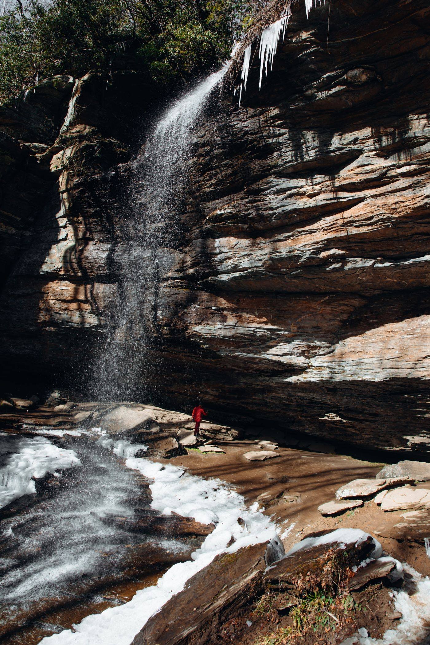
Dry Falls: Walk Behind a 75-Foot Waterfall
Dry Falls is the headline act. The Cullasaja River pours 75 feet over an overhanging cliff, and the trail passes right behind the curtain of water, which is how the falls earned the name “Dry”: in normal flow you can walk behind it and stay mostly dry. Expect mist on your face in high water, and expect the roar to make conversation pointless for a minute. It is a short paved path with stairs down from the parking area, and there is an accessible overlook deck near the top if the stairs down are not for you.
Practical notes from the Forest Service: parking is $3 per vehicle per day, payable at a fee box on site or in advance on recreation.gov, and a $15 annual pass covers Dry Falls, Whiteside Mountain, and Whitewater Falls. Buy the pass before you go if you can, because cell service is spotty in the gorge. The site is open dawn to dusk, and there are no restrooms and no drinking water, so plan around a stop in town. The Forest Service also warns that Dry Falls gets extremely busy in the middle of the day and on holidays. Go before 10 a.m. or in the last hour of light and you will likely have the walk-behind to yourself.
Bridal Veil Falls: The Drive-Under Days Are Over
Older guides still call Bridal Veil the only waterfall in North Carolina you can drive under. That was true for decades: US-64 originally curved behind the falls and every car passed underneath. It is not true anymore. Ice on the shaded road in winter and falling rock made the arrangement dangerous, the highway was rerouted in front of the falls, and the old curve behind the water is now for pedestrians only.
That is arguably better. Park in the roadside pull-off (it holds only a handful of cars, another reason to come early) and walk the old pavement behind the veil of water instead of seeing it through a windshield. In low flow you can stand behind it and stay dry; after heavy rain the veil thickens and you will get wet standing there, which most people seem to count as the point. There is no fee, and the whole stop takes fifteen minutes unless the light is doing something special.
Glen Falls: Three Tiers, One Quiet Trail
Glen Falls is the waterfall for people who want to earn it a little. The trailhead sits a few miles from downtown on a side road, and the trail descends about two miles round trip past three observation decks, one for each tier of the cascade. Where Dry Falls is a single dramatic plunge, Glen Falls is a staircase of water dropping through the forest in stages, and because it asks for a walk, it is usually the quietest of the three.
Go down slowly: the descent is the easy direction, and the climb back up is the workout, especially in summer humidity. The decks keep you at a safe distance from the slick rock, which matters here as much as anywhere. Waterfalls in this gorge have seriously injured people who climbed out for a better photo. Take the photo the deck gives you.
Beyond the Falls: Whiteside Mountain, Sunset Rock and Main Street
If you have a second day, or energy left after the loop, Highlands has more than waterfalls. Whiteside Mountain rises to 4,930 feet on the Eastern Continental Divide, and its loop trail circles some of the tallest cliffs in the east. The same Forest Service pass that covers Dry Falls works here, which makes the $15 annual an easy decision if you are doing both. Sunset Rock is the opposite kind of outing: a short walk from downtown to an open rock face with a panoramic view west, made for golden hour. Arrive half an hour before sunset, not at sunset.
Downtown itself is part of the draw. Main Street packs galleries, boutiques, and restaurants into a few walkable blocks, the Highlands Nature Center adds interactive exhibits and short nature trails, and The Bascom arts center runs exhibits and workshops. Highlands has been a summer escape from Southern heat for well over a century, and at 4,118 feet, evenings here can be 15 degrees cooler than the valleys below. Bring a layer for dinner even in July.
If You Only Have Two Hours
Do Dry Falls first, before the midday crowd, and take the walk behind it. Stop at Bridal Veil on the way back into town since it costs you fifteen minutes and no fee. Then spend the rest of the time on Main Street with coffee in hand. Skip Glen Falls and Cullasaja on a two-hour visit; they will keep for the trip where you stay overnight, and Highlands rewards the overnight: the full loop, Whiteside at midday, Sunset Rock at golden hour, and dinner downtown is simply a better day than any rushed version of it. Our Highlands hiking guide covers the trails around town in more depth.
Frequently Asked Questions
What is Highlands, NC known for?
Waterfalls and altitude. Highlands sits at 4,118 feet in the Nantahala National Forest, one of the highest incorporated towns in the eastern US, and its heavy rainfall (over 80 inches a year) keeps a dozen waterfalls running within a few miles of downtown.
Can you walk behind Dry Falls?
Yes. A paved path with stairs leads behind the 75-foot cascade. You stay mostly dry in normal flow, which is where the name comes from, but expect mist after heavy rain. Parking is $3 per vehicle per day.
Can you still drive under Bridal Veil Falls?
No. The old highway curve behind the falls is closed to cars and open to pedestrians only. You park at the roadside pull-off and walk behind the falls instead.
How many waterfalls are near Highlands?
Dozens are within a short drive, and the greatest hits line up along US-64 in the Cullasaja Gorge: Sequoyah, Bridal Veil, Dry Falls, Bust Your Butt, and Cullasaja Falls, with Glen Falls and Whitewater Falls nearby.
How far is Highlands from Asheville and Atlanta?
About 2 hours from Asheville and 2.5 to 3 hours from Atlanta, all on winding mountain roads. If you are stringing the region together, our guide to how far Asheville is from major cities helps plan the bigger loop.
When is the best time to visit Highlands for waterfalls?
After rain, whenever that happens, the falls run strongest. Spring brings rhododendron and full flow, fall brings color, and winter brings icicles and the smallest crowds. Summer weekends are the busiest; go early in the day.


, Whiteside Mountain, Sunset Rock, and Main Street tips.)