

The best hikes in Georgia include Blood Mountain, Raven Cliff Falls Trail, Mount Yonah, Brasstown Bald, Amicalola Falls, Tallulah Gorge, Cloudland Canyon, Providence Canyon, Sweetwater Creek and Arabia Mountain. These trails cover Georgia’s best mountain views, waterfall hikes, canyon routes, family walks, beginner trails and scenic hikes near Atlanta.
North Georgia has the largest concentration of mountain trails, but some of the state’s most interesting hikes sit farther south and west. That includes the colorful gullies of Providence Canyon, the forested ridges of F.D. Roosevelt State Park and the unusual rock landscape of Arabia Mountain.
This guide covers Georgia, USA, rather than the country of Georgia. It focuses on trails that work well for first-time visitors, couples, families, beginner hikers and intermediate hikers. There are also several demanding routes for hikers who want a proper climb.
Last updated: 07 July 2026
Important: This guide was prepared using official park and trail-management resources where available. Trail distances, parking rules, fees, permits and seasonal access can change, so always verify current conditions before traveling.
Quick Questions About Hiking in Georgia
What is the best hike in Georgia overall?
Blood Mountain is the best overall Georgia hike for strong hikers who want a classic North Georgia summit, Appalachian Trail scenery and wide mountain views. Beginners may prefer Anna Ruby Falls or Unicoi Lake Trail.
What are the best hikes in Georgia for first-time visitors?
Amicalola Falls Loop, Anna Ruby Falls, Sweetwater Creek Red Trail, Arabia Mountain Top Trail, and Brasstown Bald Summit Trail are good first choices. They offer strong scenery without requiring advanced hiking experience.
What is the best mountain hike in Georgia?
Blood Mountain is one of the best mountain hikes in Georgia for a classic North Georgia summit. Mount Yonah is better for strong hikers who want a steeper climb and broader open views.
What is the best waterfall hike in Georgia?
Raven Cliffs Trail is one of the best moderate waterfall hikes in Georgia because it combines several miles of shaded forest, creek scenery and a distinctive waterfall near the end of the route.
What is the best easy hike in Georgia?
Anna Ruby Falls is one of the best easy hikes in Georgia for families and first-time visitors. The route is short and paved, although the walk toward the falls is gradually uphill.
Quick Guide to the Best Hikes in Georgia
| Trail | Approximate Distance | Difficulty | Area | Best For |
| Blood Mountain | 4.3 miles | Hard | Blairsville | Classic mountain summit |
| Raven Cliffs Trail | 4.9 miles | Moderate | Near Helen | Waterfalls and shaded forest |
| Mount Yonah | 4.4 miles | Hard | Cleveland | Big summit views |
| Brasstown Bald Summit Trail | 1.2 miles | Moderate but steep | Hiawassee area | Highest-point views |
| Amicalola Falls Loop | 2.1 miles | Strenuous | Dawsonville | Large waterfall and stairs |
| Anna Ruby Falls | 0.9 mile | Easy to moderate | Helen | Families and first visits |
| Helton Creek Falls | About 0.6 miles | Easy | Blairsville | Short waterfall walk |
| Tennessee Rock Trail | 2.2 miles | Moderate | Mountain City | Fall color and overlooks |
| Hurricane Falls Loop | About 2.25 miles | Strenuous | Tallulah Falls | Gorge and suspension bridge |
| Cloudland Canyon West Rim | 5 miles | Moderate to strenuous | Rising Fawn | Canyon overlooks |
| Cloudland Canyon Waterfalls | About 1.8-2 miles | Strenuous | Rising Fawn | Waterfalls and stair workout |
| Unicoi Lake Trail | 2 miles | Easy | Helen | Relaxed family walk |
| Springer Mountain | 1.8 or 17 miles | Moderate to hard | Suches | Appalachian Trail history |
| Providence Canyon Loop | About 2.5 miles | Easy to moderate | Lumpkin | Colorful canyon scenery |
| Sweetwater Creek Red Trail | Up to 2 miles | Easy to strenuous | Lithia Springs | Ruins and river rapids |
| Arabia Mountain Top Trail | About 1.3 miles | Moderate | Stonecrest | Granite landscape |
| Mountain Creek Nature Trail | 3.2 miles | Easy to moderate | Pine Mountain | Quiet forest hiking |
Trail mileage, parking rules, fees, permits, shuttle availability and seasonal access can change. Check the latest official trail map, park alerts, and managing agency notices before leaving, especially for state parks, Forest Service roads, waterfall trails, and high-elevation routes.
How to Choose the Right Georgia Hiking Trail
The most scenic trail is not automatically the best trail for your trip.
A family with young children may have a better day at Anna Ruby Falls than on the stairs at Cloudland Canyon. A couple looking for a quiet morning may prefer the Tennessee Rock Trail over a crowded weekend climb on Blood Mountain. An experienced hiker may find Brasstown Bald too short but enjoy Mount Yonah or the Springer Mountain Approach Trail.
Use three questions to narrow your choice:
- How much climbing can everyone in your group comfortably handle?
- Do you want a waterfall, summit, canyon or relaxed forest walk?
- How much time do you actually have, including driving and parking?
Do not judge difficulty by mileage alone. A two-mile trail with hundreds of stairs may feel harder than a five-mile woodland trail with gradual elevation changes.
Best Mountain Hikes in North Georgia
North Georgia contains the state’s largest concentration of mountain summits, waterfall routes and Appalachian scenery. For a more detailed town-by-town breakdown, explore our guide to the best North Georgia trails near Helen, Blairsville, Hiawassee, Blue Ridge and Clayton.
1. Blood Mountain
Best for: A classic North Georgia summit hike
Distance: About 4.3 miles round trip
Difficulty: Hard
Blood Mountain is one of the strongest choices for hikers who want a real mountain climb without committing to an all-day route.
The most direct route starts at the Byron Herbert Reece trailhead. It climbs through a shaded forest before joining the Appalachian Trail and continuing toward the summit. The final sections become rocky, and the elevation gain is noticeable from the beginning.
At the top, exposed rock areas open to wide views across the North Georgia mountains.
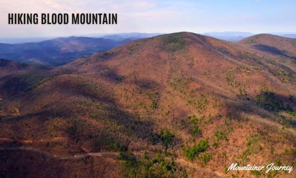
The historic stone shelter also gives the summit a sense of place that many shorter overlooks lack.
This is not the best choice for a completely unprepared beginner. The trail is relatively short, but the steady climb and uneven rock make it physically demanding.
Practical tip: Parking fills quickly on pleasant weekends. An early start gives you a better chance of finding a legal space and enjoying the summit before the busiest period.
2. Mount Yonah
Best for: Strong hikers, couples and broad summit views
Distance: About 4.4 miles round trip
Difficulty: Hard
Mount Yonah rises sharply above the surrounding countryside near Cleveland and Helen. Its shape makes the mountain easy to recognize from a distance, and the trail delivers some of the most open views in North Georgia.
The route begins gently enough, but the climb becomes steeper as you gain elevation. Parts of the trail follow a broad roadbed, while other sections pass through rocky forest.
The summit area is more exposed than many Georgia peaks. That is good for views, but it also means hikers should stay well back from cliff edges.
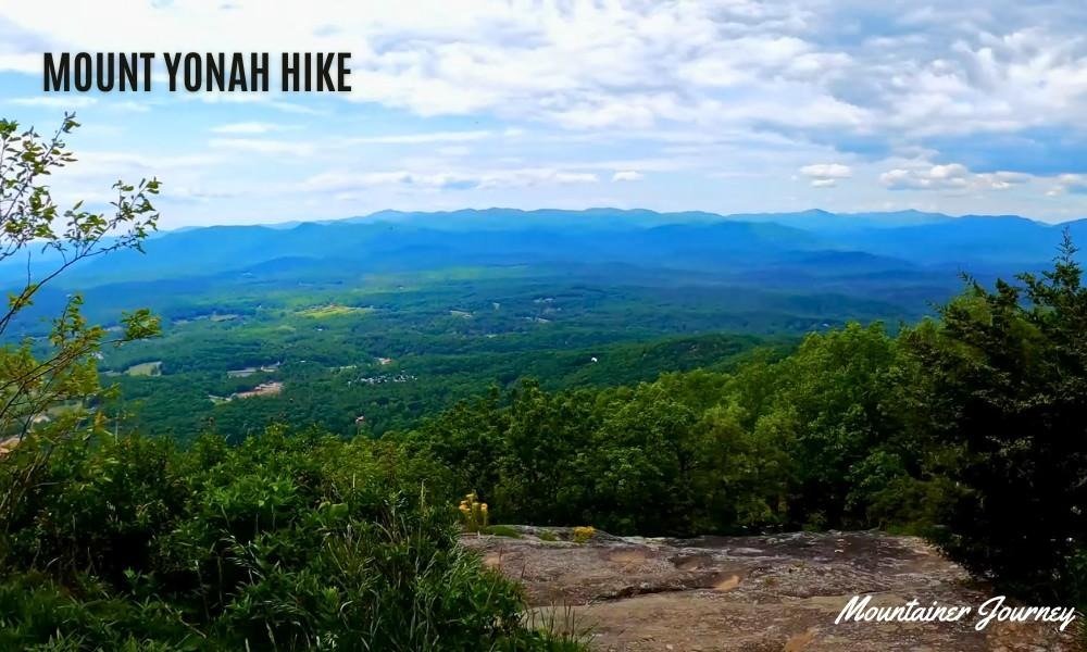
Mount Yonah works well for fit couples and intermediate hikers who want a rewarding half-day outing. It is less suitable for small children, people with weak knees or anyone uncomfortable around exposed rock.
Practical tip: Bring more water than you think you need. The sustained climb feels much harder in warm, humid weather.
3. Brasstown Bald Summit Trail
Best for: Reaching Georgia’s highest point without a long hike
Distance: About 1.2 miles round trip
Difficulty: Moderate because of the steep grade
Brasstown Bald is the highest point in Georgia, and the short summit trail connects the parking area with the viewing platform.
The surface is paved, but that does not make the walk effortless. The trail is steep enough to make many visitors stop for a break on the way up.
At the summit, the viewing area provides broad mountain views that can extend across multiple states on a clear day.

It is a good choice for travelers who want a major viewpoint but do not have time for a longer backcountry hike.
A shuttle may operate as an alternative to walking, depending on the season and visitor-center schedule.
Practical tip: Weather at the summit can feel cooler and windier than it does in the parking area. Carry a light layer outside in the summer.
4. Tennessee Rock Trail
Best for: Fall color, moderate hiking and quieter mountain scenery
Distance: 2.2-mile loop
Difficulty: Moderate
Tennessee Rock Trail sits inside Black Rock Mountain State Park, the highest-elevation state park in Georgia.
The trail passes through a lush mountain forest before reaching overlooks across the Blue Ridge landscape.
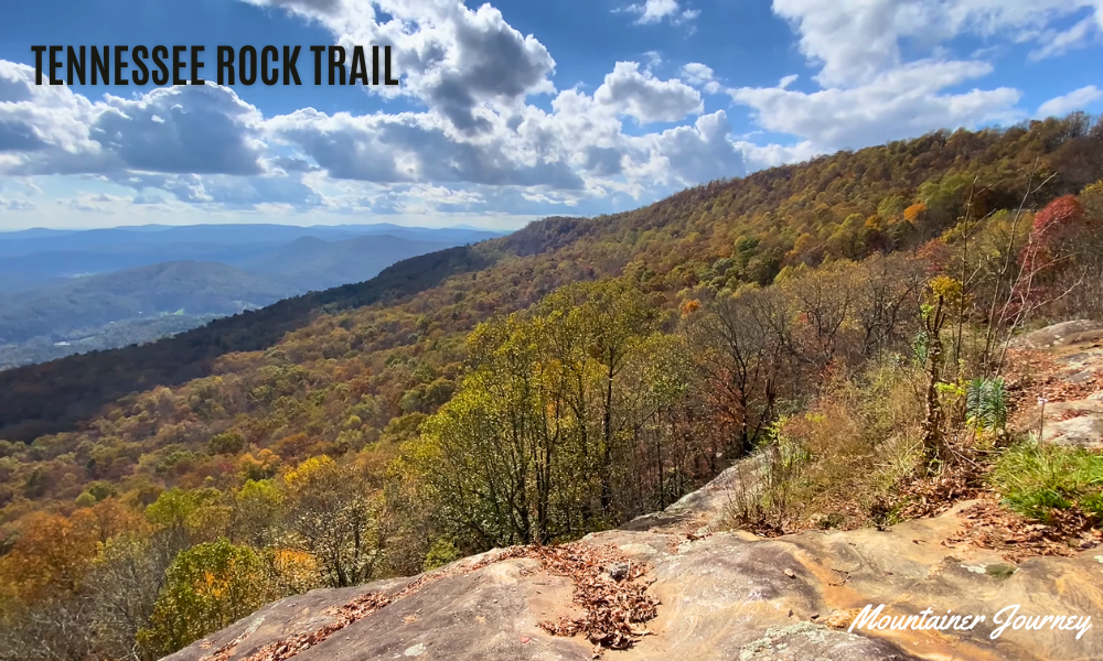
It is long enough to feel like a proper walk but short enough to combine with roadside viewpoints and other park stops.
This is one of the better North Georgia hikes for visitors who want mountain scenery without the sustained climb of Blood Mountain or Mount Yonah.
The route still contains roots, inclines and uneven natural surfaces, so normal walking shoes are not ideal after rain.
Practical tip: Visit on a weekday during the fall-color season. Mountain parks can become crowded on peak October weekends.
5. Springer Mountain
Best for: Appalachian Trail history and experienced hikers
Distance: About 1.8 miles round trip from Forest Service Road 42, or 17 miles round trip using the full approach trail.
Difficulty: Moderate from the forest road; hard from Amicalola Falls
Springer Mountain marks the southern end of the Appalachian Trail. For many long-distance hikers, the summit represents the beginning of a journey that continues far beyond Georgia.
Day hikers have two very different ways to reach it.
The shorter option starts near Forest Service Road 42 and follows the Appalachian Trail to the summit. The longer route begins at Amicalola Falls State Park and uses the 8.5-mile Approach Trail, one way.
The full approach trail contains several difficult climbs and should not be treated as a casual extension of a waterfall visit. It is better suited to conditioned hikers, backpackers or people training for longer routes.
Anyone planning the full Approach Trail or a longer Appalachian Trail section should prepare more carefully than a short day hiker. Carry proper footwear, layered clothing, navigation tools, enough water, food and basic emergency items before starting.
The summit views are not as open as those on Mount Yonah, but the trail’s history makes it one of the most meaningful hiking destinations in Georgia.
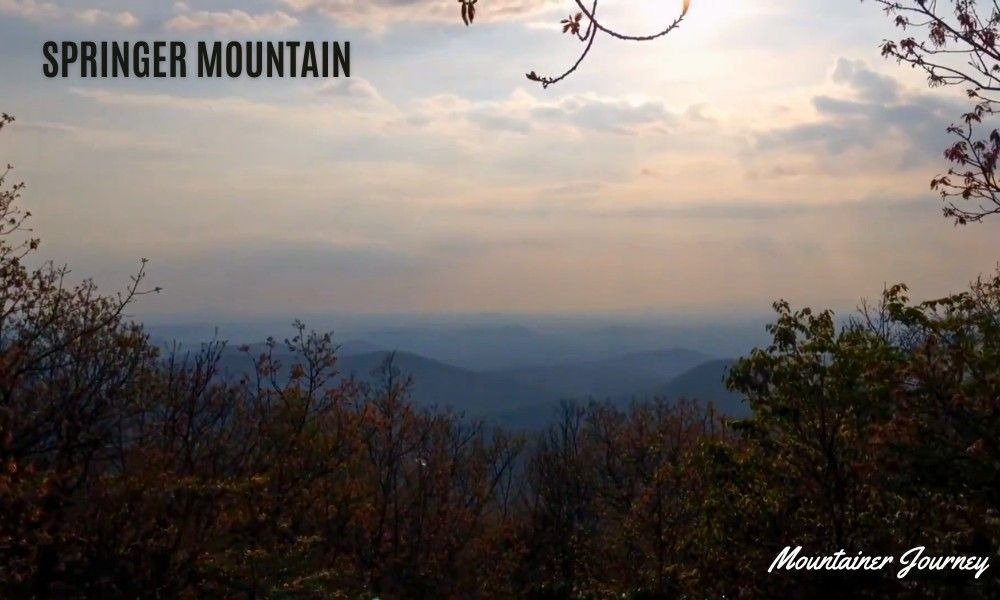
Practical tip: Do not rely on a normal passenger car reaching every forest-road trailhead comfortably after poor weather. Check road conditions before leaving.
Best Waterfall Hikes in Georgia
6. Raven Cliffs Trail
Best for: The best balance of distance, scenery and manageable difficulty
Distance: About 4.9 miles round trip
Difficulty: Moderate
Raven Cliffs Trail is one of the best hikes in Georgia for visitors who want more than a quick walk to a viewing platform.
The trail follows Dodd Creek through a shaded valley filled with smaller cascades, mossy rocks and dense forest. Near the end, Raven Cliff Falls appears where water passes through a split in a large rock cliff.
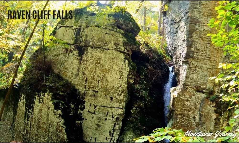
Most of the route feels gradual compared with Georgia’s steeper summit hikes. Roots, wet rocks and muddy sections can still make the trail tiring, especially after heavy rain.
Raven Cliffs Trail is a good middle-ground choice for couples, older children and beginners ready to move beyond short paved trails.
Practical tip: The final area around the falls can be slippery. Stay on the established trail rather than climbing the surrounding rock.
7. Amicalola Falls Loop
Best for: A dramatic waterfall and a serious stair workout
Distance: About 2.1 miles
Difficulty: Strenuous
Amicalola Falls is one of Georgia’s best-known natural landmarks. According to Amicalola Falls State Park, the waterfall is 729 feet tall, and visitors can choose easier viewing areas or more challenging staircase routes
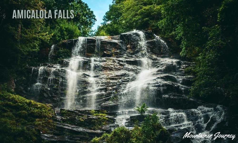
The mileage looks modest, but the stairs make this hike harder than many first-time visitors expect. People with knee problems may be more comfortable visiting the drive-up viewpoints rather than completing the full loop.
Families can still enjoy the park without walking every section. Different parking areas provide access to the lower pool, middle viewing area and upper part of the falls.
For fit visitors, the full route is worth the effort. The sound and scale of the water become more impressive as you move between viewing levels.
Practical tip: Decide your route before leaving the visitor center. Driving between viewing areas is a sensible option for mixed-ability groups.
8. Anna Ruby Falls
Best for: Families, first-time visitors and a short scenic walk
Distance: About 0.9 mile round trip
Difficulty: Easy to moderate
Anna Ruby Falls is one of the easiest ways to see a large North Georgia waterfall on foot.
The paved path follows a lively creek through the forest and climbs gradually toward two viewing platforms. Although the route is short, most of the walk to the falls is uphill.
At the end, two separate streams drop beside each other to create the twin falls.
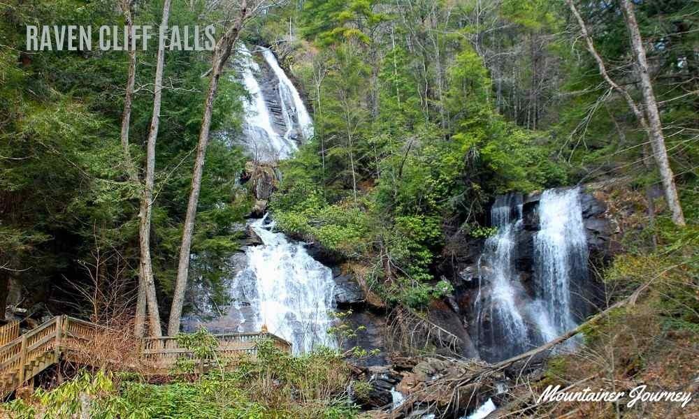
The platforms make it easier for families to stop, take photos and enjoy the view without walking on loose rock.
The trail is often described as family-friendly and stroller-friendly, but the incline can still require effort when pushing a stroller.
Practical tip: Arrive early during summer weekends and fall-color season. The trail is short, popular and close to Helen.
9. Helton Creek Falls
Best for: A short waterfall stop with children
Distance: About 0.6 mile round trip
Difficulty: Easy
Helton Creek Falls gives visitors two waterfall views without requiring a long hike.
The path moves through the forest to the lower falls and then continues toward the larger upper cascade.
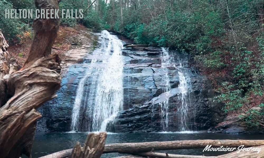
It works well as a short outing or as an extra stop during a day around Blairsville, Vogel State Park or Blood Mountain.
The trail surface is natural rather than paved, so mud and exposed roots are possible. The access road can also be rougher than the trail itself.
Practical tip: Check road conditions before visiting, especially after heavy rain. Keep children away from wet rock near the water.
10. Cloudland Canyon Waterfalls Trail
Best for: Waterfalls and a demanding stair climb
Distance: Roughly 1.8 to 2 miles round trip
Difficulty: Strenuous
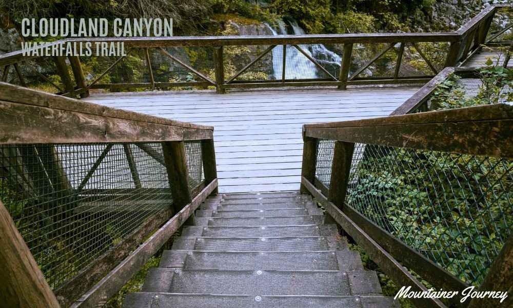
Cloudland Canyon’s Waterfalls Trail drops from the rim toward Cherokee Falls and Hemlock Falls.
The route is short on paper but includes approximately 600 stairs.
The descent can feel easy at first; the return climb is where most hikers feel the difficulty.
Water flow varies by season and rainfall. The canyon itself remains impressive even when the waterfalls are lighter, with curved rock walls, boulders and a shaded forest floor.
This trail is not a good match for people with serious knee trouble. Dogs may also struggle on the metal stairs.
Practical tip: Take your time on the return climb and allow faster hikers to pass at wider landings.
Best Canyon and Gorge Hikes in Georgia
11. Tallulah Gorge Hurricane Falls Loop
Best for: Dramatic gorge views and a suspension bridge
Distance: About 2.25 miles
Difficulty: Strenuous
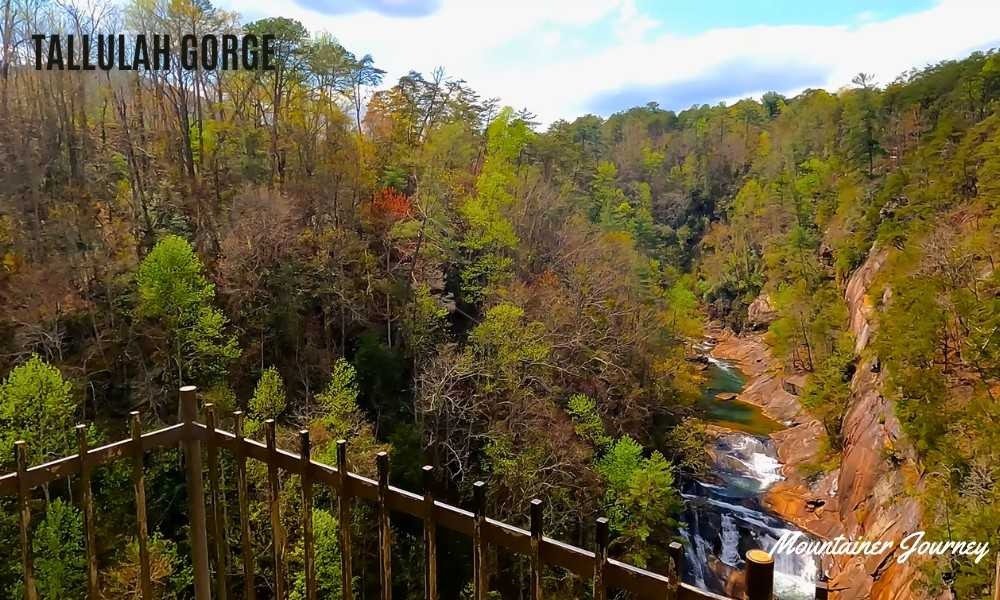
Tallulah Gorge is one of Georgia’s most dramatic landscapes. The gorge stretches for roughly two miles, with steep walls, waterfalls and multiple overlooks.
The Hurricane Falls Loop descends from the rim using a long staircase and crosses a suspension bridge above the gorge floor.
The route involves hundreds of stairs, making it much harder than its mileage suggests.
Visitors who do not want the stair climb can stay on the North and South Rim Trails. Those trails cover roughly three miles and provide several gorge views without requiring a descent to the bridge.
Access to the actual gorge floor is different from the standard Hurricane Falls route and may require a free permit. Availability depends on conditions and scheduled water releases.
Practical tip: Choose the rim trail when traveling with small children, older relatives or anyone unsure about climbing a long staircase.
12. Cloudland Canyon West Rim Loop
Best for: The best all-around canyon hike in Georgia
Distance: 5 miles
Difficulty: Moderate to strenuous
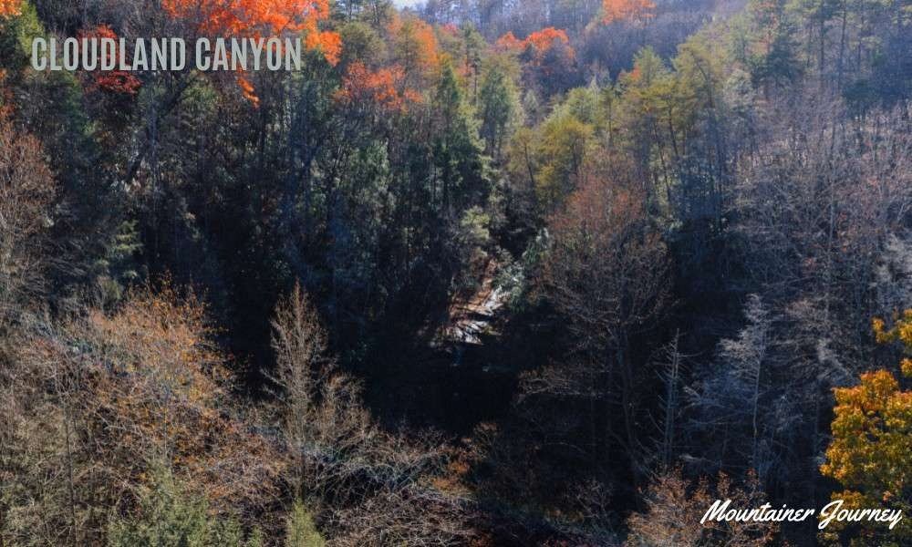
The West Rim Loop offers a better choice than the Waterfalls Trail for hikers who care more about open canyon views than about standing beside a waterfall.
The trail crosses rocky and root-covered ground before following the western side of the canyon. Several overlooks provide views across the gorge and surrounding ridges.
At five miles, the route gives visitors enough time in the landscape without becoming a full-day backpacking trip. There are climbs, but the experience is more balanced than the stair-heavy waterfall route.
This is one of the best hiking trails in Georgia during fall, when the canyon forest changes color.
Practical tip: Complete the full loop rather than turning around at the first viewpoint. The western overlooks are the main reward.
13. Providence Canyon Loop
Best for: Unusual geology and colorful canyon photographs
Distance: About 2.5 miles
Difficulty: Easy to moderate
Providence Canyon looks different from the forested gorges of North Georgia. Its exposed walls show bands of red, orange, pink and white soil, which have earned the area the nickname “Georgia’s Little Grand Canyon.”
The Canyon Loop provides views from both the rim and lower creek-bed areas. A thin layer of water or mud is common on parts of the canyon floor, even during otherwise dry weather.
The trail is manageable for many families, but visitors should not climb the fragile canyon walls. Erosion created the landscape and continues to reshape it.
Providence Canyon is far from North Georgia, so it works best as a separate day trip rather than an addition to a Blue Ridge itinerary.
Practical tip: Wear shoes that can handle mud. Light-colored footwear may not stay light for long.
Best Easy and Family-Friendly Hikes in Georgia
14. Unicoi Lake Trail
Best for: A calm family walk near Helen
Distance: About 2 miles
Difficulty: Easy
The Unicoi Lake Trail loops around the water inside Unicoi State Park.
The trail offers lake views, forest shade and access to several park facilities.
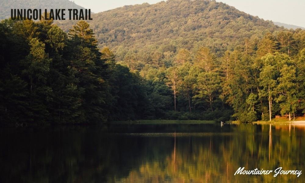
It lacks the major summit or waterfall payoff of other trails in this guide, but that is also part of its appeal.
Families can walk at a relaxed pace without dealing with long staircases or exposed cliffs. It is also a useful alternative when Anna Ruby Falls is too crowded.
Practical tip: Combine the walk with a picnic or a visit to Helen rather than treating it as an all-day hike.
15. Sweetwater Creek Red Trail
Best for: Hiking near Atlanta, river rapids and historic ruins
Distance: Up to 2 miles round trip
Difficulty: Easy at first, then more strenuous
Sweetwater Creek State Park sits close enough to Atlanta for a convenient half-day escape.
The first section of the Red Trail leads to the ruins of the New Manchester mill beside the creek. This part is the best choice for families and first-time visitors.
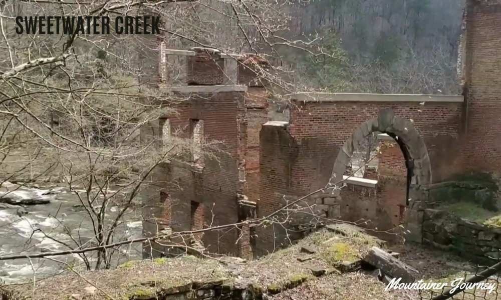
Beyond the ruins, the trail becomes rockier and more demanding as it follows the rapids. You can turn around at the mill if your group wants a shorter and easier outing.
The combination of history, forest and moving water makes this hike feel more varied than many urban-area trails.
Practical tip: Do not assume the entire Red Trail is as easy as the path to the ruins. The downstream section requires better footwear and balance.
16. Arabia Mountain Top Trail
Best for: A short hike with unusual scenery near Atlanta
Distance: About 1.3 miles
Difficulty: Moderate
Arabia Mountain replaces the usual forest path with broad granite, shallow pools and low-growing plants.
Rock cairns help mark the route toward the top.
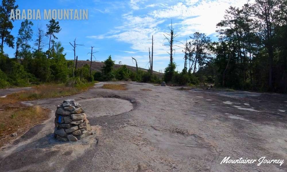
The climb is not especially high, but the exposed surface can feel hot during the middle of a summer day.
The summit provides wide views over the surrounding preserve. Spring can be especially interesting when delicate plants appear in the shallow solution pools.
Stay on the marked route and avoid stepping through sensitive plant areas.
Practical tip: Visit near sunrise or later in the afternoon during warm months. There is very little shade on the exposed rock.
17. Mountain Creek Nature Trail
Best for: A quiet, lower-pressure forest hike
Distance: 3.2 miles
Difficulty: Easy to moderate
Mountain Creek Nature Trail is one of several day-hike loops connected with the Pine Mountain Trail system at F.D. Roosevelt State Park.
The route passes through mixed forest and several plant habitats without demanding the commitment of the full 23-mile trail.
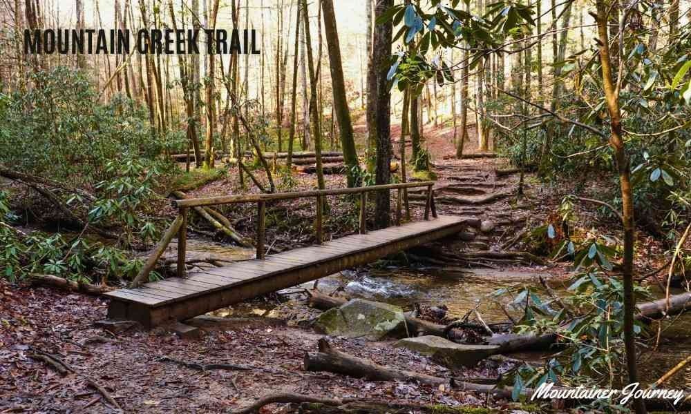
This is a useful choice for visitors traveling in western Georgia or anyone who wants a peaceful woodland walk away from the busier North Georgia parks.
It does not provide the dramatic mountain summit of Blood Mountain, but the gentler terrain makes it more approachable for casual hikers.
Practical tip: Pick up a current park map. The wider Pine Mountain Trail system has several intersections and route options.
Best Georgia Hike for Each Type of Visitor
| Visitor Type | Best Trail | Why It Fits |
| First-time visitors | Anna Ruby Falls | Short, scenic and easier than Georgia’s steep summit or gorge hikes |
| Families with children | Anna Ruby Falls or Unicoi Lake Trail | Both are easier, scenic and less demanding than stair-heavy routes |
| Couples | Tennessee Rock Trail or Raven Cliffs Trail | Both offer forest scenery, overlooks or waterfall views without feeling too extreme |
| Beginner hikers | Arabia Mountain or Sweetwater Creek Red Trail | Both are close to Atlanta and can be shortened depending on energy level |
| Intermediate hikers | Blood Mountain or Cloudland Canyon West Rim Loop | These routes provide stronger scenery, more climbing and a more rewarding trail feel |
| Waterfall lovers | Raven Cliffs Trail or Amicalola Falls Loop | Raven Cliffs feels like a full forest hike, while Amicalola offers a famous waterfall experience |
| Canyon lovers | Tallulah Gorge or Cloudland Canyon | Tallulah gives dramatic gorge views, while Cloudland Canyon offers broader canyon overlooks |
| Hikers near Atlanta | Sweetwater Creek Red Trail or Arabia Mountain Top Trail | These are practical choices when you want a scenic hike without driving deep into North Georgia |
Best Time to Go Hiking in Georgia
Spring
Spring brings comfortable temperatures, stronger waterfall flow, and fresh forest growth. It is one of the best seasons for Raven Cliffs Trail, Anna Ruby Falls, and Cloudland Canyon.
Rain also creates mud and slippery rock, so waterproof footwear or trail shoes with strong grip helps.
Summer
Mountain forests provide some shade, but Georgia humidity can make moderate hikes feel difficult.
Start early, carry extra water, and avoid exposed trails such as Arabia Mountain during the hottest part of the day. Wear breathable clothing, use sun protection, and choose shaded waterfall or forest trails when the heat is high.
Fall
Fall is the most popular season for hiking in North Georgia. Blood Mountain, Black Rock Mountain, Cloudland Canyon, and Fort Mountain are strong choices for foliage.
October weekends can be extremely busy. Start early or visit during the week if you want easier parking and quieter trails.
Winter
Winter provides clearer views through leafless trees and fewer crowds. Ice can form on shaded stairs, bridges, waterfalls, and high-elevation trails.
Check the forecast and park alerts before driving into mountain areas. Wear warm layers, choose footwear with good grip, and avoid icy stairs, bridges, or exposed summit trails if you are not prepared.
Georgia Hiking Safety Tips
Check the official trail page
Trail access, parking rules, permits, pet policies, and closures can change. Check the park or Forest Service page on the morning of your trip.
Many Georgia State Parks require a ParkPass. As of 2026, Georgia State Parks lists daily parking at $10 per vehicle and an annual ParkPass at $70, so check the current fee before visiting.
Stay off waterfall rocks
Wet rock around a waterfall is far more slippery than it looks. Do not climb beside or above waterfalls for a photo.
Carry enough water
Short, steep hikes can require more water than longer flat walks. This is especially true during Georgia’s humid summer months.
Download your map before leaving
Phone coverage can be weak in mountain and forest areas. Save the trail map offline, keep a screenshot of the route, and note important junctions before starting.
If you are hiking a longer or less familiar route, tell someone your plan before you leave.
Pack the basics
For longer or less familiar hikes, follow the NPS 10 Essentials guidance and carry navigation, sun protection, extra clothing, water, food, first aid, and basic emergency items.
Watch the weather
A thunderstorm can make exposed summits, creek crossings, and metal staircases unsafe. Turn around when conditions deteriorate.
Keep wildlife wild
Black bears live in parts of North Georgia. Do not approach wildlife or leave food unattended.
Leave the trail as you found it
Stay on established routes, carry out your rubbish, and avoid damaging plants, canyon walls, or rock formations.
Common Georgia Hiking Mistakes
Assuming a short trail will be easy
Amicalola Falls, Tallulah Gorge, and Cloudland Canyon all include steep stairs. Their mileage does not show the full physical demand.
Arriving at midday
Popular trailheads can fill by late morning on weekends, particularly during spring and fall.
Wearing smooth everyday shoes
Wet roots, muddy paths, and loose rock require grip. Hiking shoes or trail-running shoes are a safer choice.
Depending entirely on online difficulty ratings
Difficulty is personal. Stairs, elevation, heat, humidity, and carrying a child can change how a trail feels.
Ignoring the return journey
A downhill start means an uphill finish. Cloudland Canyon’s Waterfalls Trail is a clear example.
Trying to fit too many hikes into one day
Mountain roads can be slow and winding. Choose one main trail and one nearby short stop rather than rushing between several regions.
Final Verdict
The best hikes in Georgia depend on the experience you want.
For a classic North Georgia summit, start with Blood Mountain. For waterfalls and a moderate woodland route, Raven Cliffs Trail is the strongest all-around choice. Families should consider Anna Ruby Falls or Unicoi Lake Trail. Cloudland Canyon is the top option for canyon views, while Providence Canyon shows a completely different side of the state.
If you want to hike near Atlanta, choose Sweetwater Creek, Arabia Mountain, or Kennesaw Mountain. If you want a harder mountain climb, choose Mount Yonah, Blood Mountain, or the full Springer Mountain Approach Trail.
First-time visitors should resist choosing a trail based only on photos. Match the route to your group’s fitness, allow extra time, and check official conditions before leaving.
Georgia hiking is at its best when the trail fits the people walking it.
Frequently Asked Questions
1. What are the best beginner-friendly hikes in Georgia?
Anna Ruby Falls, Arabia Mountain, Unicoi Lake Trail, and the easier section of Sweetwater Creek Red Trail are good beginner-friendly hikes in Georgia. They offer scenery without the same level of climbing found on Blood Mountain, Mount Yonah, or Tallulah Gorge.
2. Which Georgia hikes have the best mountain views?
Blood Mountain, Brasstown Bald, Mount Yonah and Tennessee Rock Trail offer some of the best mountain views in this guide. Choose Brasstown Bald for a short steep walk and Blood Mountain or Mount Yonah for a harder summit hike.
3. What are the best waterfall hikes in Georgia?
Popular waterfall hikes in this guide include Raven Cliffs Trail, Amicalola Falls Loop, Anna Ruby Falls, Helton Creek Falls and Cloudland Canyon Waterfalls Trail.
4. What are the best hikes near Atlanta?
Sweetwater Creek Red Trail and Arabia Mountain Top Trail are two of the best hikes near Atlanta in this guide. Sweetwater Creek is best for forest, ruins and river scenery, while Arabia Mountain is best for open granite scenery.
5. When is the best time to hike in Georgia?
Spring and fall are usually the best seasons for hiking in Georgia. Spring is good for waterfalls and fresh forest scenery, while fall is best for cooler weather and North Georgia mountain color.
6. Do Georgia hiking trails charge parking or entrance fees?
Some Georgia trails require parking or entrance fees, especially state parks and managed recreation areas. Many Georgia State Parks require a Park Pass, so check the official park page before your visit.
7. What should I pack for hiking in Georgia?
Carry water, snacks, sunscreen, insect repellent, rain protection, a basic first-aid kit, and comfortable hiking shoes. For longer hikes, add offline maps, extra clothing, a headlamp, and emergency supplies.
8. Are dogs allowed on Georgia hiking trails?
Many Georgia hiking trails allow leashed dogs, but pet rules vary by park and trail. Some stair-heavy routes, such as Cloudland Canyon’s Waterfalls Trail, may be difficult for dogs, so always check the official trail policy before visiting.