

Last updated: October 14, 2026
The drive from Charlotte to Asheville is one of the easiest city-to-mountains transitions in the Southeast: two hours on the interstate and the skyline gives way to the Blue Ridge. This guide covers the exact distance and drive time, the best route, where to stop, the scenic detours worth the extra miles, and the driving tips that make the trip smooth.
How Far Is Asheville from Charlotte?
Asheville is about 130 miles west of Charlotte, and the drive takes roughly 2 hours via I-40 West in normal traffic. It is a straightforward interstate run for the first 90 minutes, then the road climbs into the mountains for the final stretch past Black Mountain. Leave Charlotte by 8 or 9 in the morning and you will be in Asheville in time for lunch.
The Best Route: I-40 West
There is really only one route worth considering: I-40 West from Charlotte straight to Asheville. It is the fastest, simplest, and best-maintained option, and the mountain section is genuinely scenic rather than white-knuckle. The interstate climbs past Black Mountain before dropping into the French Broad River valley at Asheville.
The climb itself is part of the experience. The interstate gains well over a thousand feet between Marion and Black Mountain, and on a clear day the views open up across the ridges to the north. In October this stretch glows with color, which is exactly why fall weekends back up with leaf-lookers.
What to expect: the first half is flat Piedmont highway through Gastonia, Hickory, and Morganton. Past Marion, the road starts climbing, the curves tighten, and trucks slow down on the grades. This is the prettiest part of the drive, especially in October. Take exit 53B onto I-240/US-74A West for downtown Asheville, or continue a few miles for Biltmore Village and the south side.
Best Stops Between Charlotte and Asheville
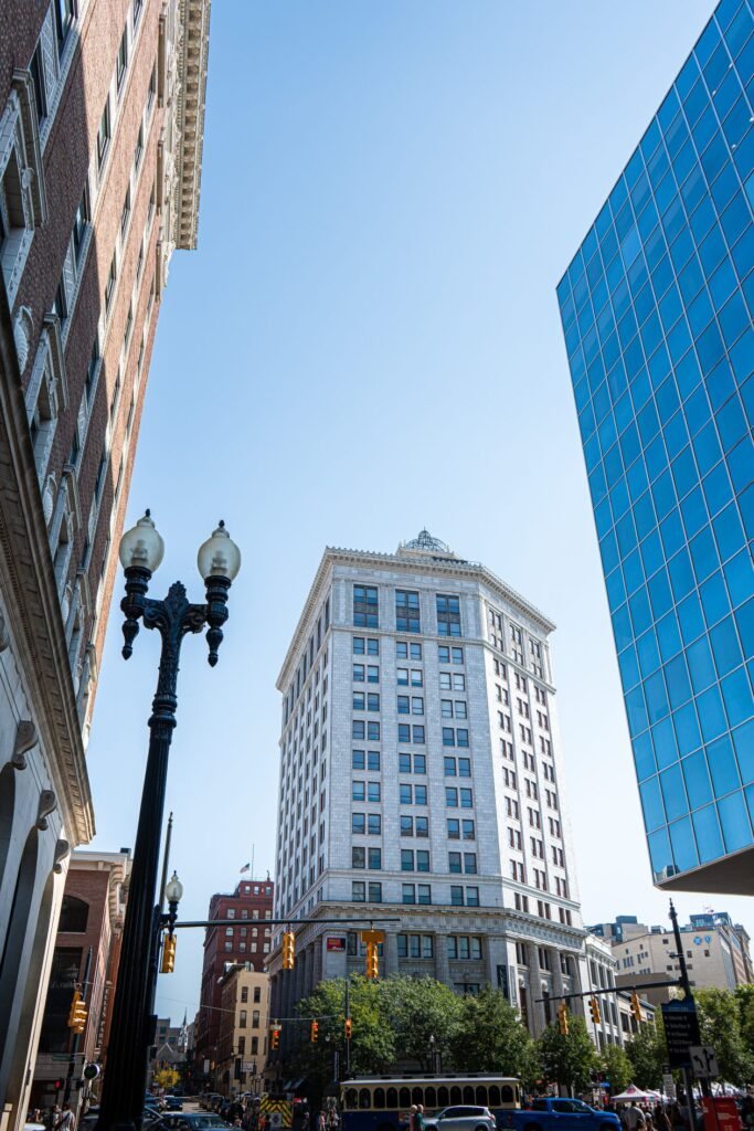
You can do this drive nonstop in two hours, but four stops break it up well without adding much time. Hickory works for a proper lunch break, Lake James is the summer swimming stop, Marion is the last easy services before the mountain climb, and Black Mountain is the charming town you will want to revisit. Pick one or two based on your schedule:
| Stop | Where | Why stop | Time needed |
|---|---|---|---|
| Hickory | About 1 hour from Charlotte | Furniture outlets, walkable downtown, lunch options | 1 hour |
| Lake James State Park | Just off I-40 near Marion | Swimming beach, easy trails, mountain lake views | 1 to 2 hours |
| Marion | About 35 minutes from Asheville | Small downtown, last easy gas and food before the climb | 30 minutes |
| Black Mountain | About 20 minutes from Asheville | Charming main street, Lake Tomahawk walk | 1 hour |
If you only make one stop, make it Black Mountain: it is the most charming town on the route and barely adds any time. Lake James is the best choice on a hot summer day, since the swimming beach is a genuine reward. Our guide to day trips from Asheville covers Black Mountain in more detail once you arrive.
Scenic Detours Worth the Extra Time
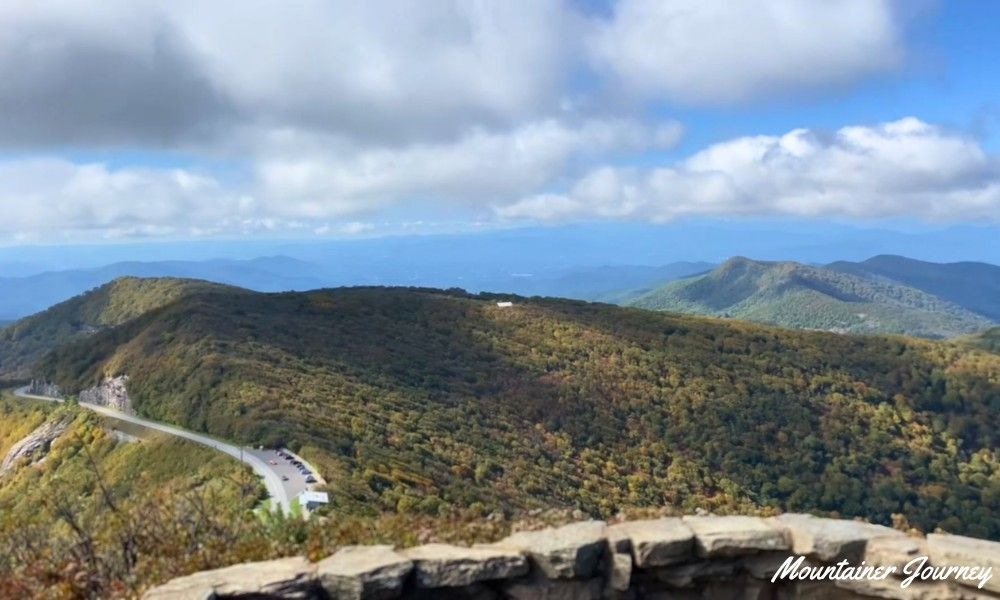
If you have an extra hour or two, these detours beat the interstate and show you the mountains properly. The Blue Ridge Parkway detour trades speed for ridge-top views, while the Chimney Rock loop adds the region’s most famous rock formation and a lakeside town. Both are worth it when you are not in a hurry:
Blue Ridge Parkway detour. Near Marion, you can hop onto the Blue Ridge Parkway and follow it south to Asheville, trading interstate speed for ridge-top views. It adds roughly an hour but includes some of the finest overlooks near the city. Check Parkway closures in winter before committing.
Chimney Rock and Lake Lure detour. From I-40, take US-74 East toward Rutherfordton, then US-64/74A to Chimney Rock and Lake Lure before looping back to Asheville via US-74A West. This adds about 90 minutes and delivers the region’s most famous rock monolith plus a lakeside town in one swing.
The honest take: if this is your first trip, just take I-40 and save the detours for the drive home, when you will know the area and can judge your energy. The detours are best enjoyed unhurried.
Driving Tips for the Mountain Stretch
- Watch for trucks on the grades. The climb past Black Mountain is steep; trucks crawl in the right lane and traffic bunches behind them. Stay left, stay patient.
- Fill up before Marion. Gas is easy to find along the whole route, but prices climb closer to Asheville and stations thin out on the detours.
- October means traffic. Fall foliage weekends can add 30 to 60 minutes, especially Sunday afternoons heading back toward Charlotte. Leave early or late.
- Winter weather. I-40 stays open in almost all weather, but ice can slow the mountain stretch. The Parkway detour is the one to skip in winter, not the interstate.
- Phone signal. Coverage is fine on I-40 the whole way. It only drops if you take the Parkway or gorge detours, so download offline maps for those.
Alternatives to Driving
Driving is the clear winner for this route: it is faster and cheaper than any alternative, and you will want a car in Asheville anyway for the trails, waterfalls, and Parkway. Asheville Regional Airport (AVL) has connecting flights through Charlotte (CLT), but flying saves no meaningful time once you count airport overhead. Bus service exists but takes several hours with transfers. If you are visiting Asheville without wanting to drive at all, that is a different trip; see our main Asheville guide for the car-free reality.
Best Time to Make the Drive
Weekday mornings are the fastest: leave Charlotte between 8 and 10 and you will miss both cities’ rush hours. Friday afternoons are the worst, as weekend traffic stacks up on I-40 West from about 3 PM. Sunday afternoons reverse the problem, with heavy eastbound traffic back toward Charlotte. In October, add at least 30 minutes either way and consider leaving at off-peak hours. Winter is the quietest season on this road, with the only caveat being the occasional ice event on the mountain stretch.
Frequently Asked Questions
How far is Asheville from Charlotte?
Asheville is about 130 miles west of Charlotte, roughly a 2-hour drive via I-40 West in normal traffic.
How far is Charlotte from Asheville?
Charlotte is about 130 miles east of Asheville, roughly a 2-hour drive via I-40 East. It is the same road in reverse.
How long does it take to drive from Charlotte to Asheville?
About 2 hours nonstop. Add 30 to 60 minutes on fall foliage weekends, and 1 to 2 hours if you take the scenic detours.
Is the drive from Charlotte to Asheville scenic?
The first half is ordinary interstate; the second half, past Marion into the mountains, is genuinely scenic, especially in fall. For the full scenic experience, detour onto the Blue Ridge Parkway.
What is the best stop between Charlotte and Asheville?
Black Mountain, about 20 minutes before Asheville: a charming main street and a lake walk that barely add any drive time. Lake James State Park is the best summer stop.
Can you do Charlotte to Asheville as a day trip?
It is a long day but doable: 2 hours each way leaves you 6 to 8 hours in Asheville. It works for Biltmore or downtown, but not for a serious hike. An overnight is far better.
Final Thoughts
Two hours, one interstate, and you trade the skyline for the ridgeline. The Charlotte to Asheville drive is simple enough to do on a Friday after work and rewarding enough to feel like a real getaway. Take I-40, stop in Black Mountain, and be in the mountains by lunch.


