

Asheville, North Carolina, is a hiker’s paradise, surrounded by dense forests, dramatic rocky summits, and some of the most scenic routes along the Blue Ridge Parkway. Whether you are looking for a quick nature walk or a challenging mountain climb, the best hiking trails around Asheville offer something for every skill level.
This guide is designed for outdoor enthusiasts, families, and beginners looking to explore Western North Carolina. You will get a complete breakdown of the top trails, including distance, difficulty, parking details, and safety tips, so you can pick the perfect adventure without any guesswork.
Last updated: July 2026
Important: Information, road access, and trail conditions can change. Always check official sources before visiting.
Quick Questions About Hiking Near Asheville
What is the best short hike on the Blue Ridge Parkway?
Craggy Pinnacle is the best quick stop for panoramic views. If you prefer walking on an open, grassy ridgeline instead of a forest, Black Balsam Knob is another stunning short option.
Which Asheville trails are the best choices for families?
The DuPont Waterfall Route features wide paths and three waterfalls to keep kids engaged. For a shorter, quieter walk with very little climbing, Moore Cove Falls is a fantastic choice.
What is the most challenging day hike in this guide?
Looking Glass Rock is the most demanding, requiring a steep 1,700-foot climb through continuous switchbacks. If you want a tough but shorter workout, try the Mount Pisgah Trail.
Where can I find a long walk without steep mountain climbs?
Pink Beds Loop is a gentle 5.5-mile trek through deep forests and wetlands. It is perfect if you want a long, scenic hike without the sharp mountain ascents.
Which towns are the best bases for exploring these trails?
Downtown Asheville is highly convenient for Parkway hikes like Craggy Pinnacle. However, if you want to focus entirely on waterfalls and forest loops, staying in Brevard puts you much closer to the action
How This Guide Was Prepared
The trails were compared using route distance, elevation change, practical difficulty, scenery, parking and seasonal access.
Stable trail information was reviewed using resources from the National Park Service, U.S. Forest Service, N.C. Forest Service and Conserving Carolina. Because mountain roads and trails can close with little notice, current access should always be checked on the morning of your hike.
Asheville Hikes Comparison at a Glance
| Trail | Distance | Difficulty | Area | Best For |
| Craggy Pinnacle | 1.4 mi | Moderate | Blue Ridge Parkway | Quick panoramic views |
| Mount Pisgah | 3.2 mi | Mod/Hard | Blue Ridge Parkway | Short summit workout |
| Black Balsam | 1.4–2 mi | Moderate | Pisgah Forest | Open mountain scenery |
| Graveyard Fields | 1.2+ mi | Easy/Mod | Blue Ridge Parkway | Waterfalls & fall color |
| Catawba Falls | 3.5 mi | Moderate | Pisgah Forest | Waterfall adventure |
| DuPont Route | 3.0 mi | Moderate | DuPont Forest | Three major waterfalls |
| Moore Cove | 1.4 mi | Easy | Pisgah Forest | Beginners & families |
| Bearwallow Mtn | 2.0 mi | Moderate | Hickory Nut Gorge | Sunset meadow views |
| Pink Beds Loop | 5.5 mi | Easy/Mod | Pisgah Forest | Gentle forest hiking |
| Looking Glass | 6.2 mi | Hard | Pisgah Forest | Challenging day hike |
How to Choose the Right Asheville Hiking Trail
Choosing the right hike requires more than just checking mileage. Consider these factors before heading out:
- Fitness Level: Distance alone does not determine difficulty. A 1.4-mile mountain climb (like Craggy Pinnacle) can be harder on your knees than a flat 5.5-mile forest walk (like Pink Beds).
- Time Available: If you have under two hours, choose Bearwallow Mountain or Moore Cove Falls. For a half-day adventure, aim for Looking Glass Rock or the complete Catawba Falls Loop.
- Suitability: Traveling with strollers or young kids? Stick to the lower section of Catawba Falls or the main loop at Graveyard Fields.
- Weather and Season: Exposed trails like Black Balsam Knob are dangerous during summer thunderstorms. Save open ridges for clear days and forest loops for windy or overcast weather.
Best Mountain and Scenic Hikes
1. Craggy Pinnacle Trail
Best for: Travelers with limited time wanting a mountain summit experience.
Distance: 1.4 miles round trip
Difficulty: Moderate
Trail type: Out-and-back
Nearest base: Asheville
Parking: Craggy Dome parking area (Milepost 364.1)
Dogs: Allowed on leash
Craggy Pinnacle offers one of the best view-to-effort ratios near Asheville. The route is short, but roots, rocks, and stone steps make it more demanding than a flat nature walk.
The trail passes through twisted mountain trees and thick rhododendron before reaching several overlooks. On a clear day, the summit provides broad views across the Blue Ridge Mountains. Clear mornings are often best for distant visibility, while late afternoon provides dramatic light.
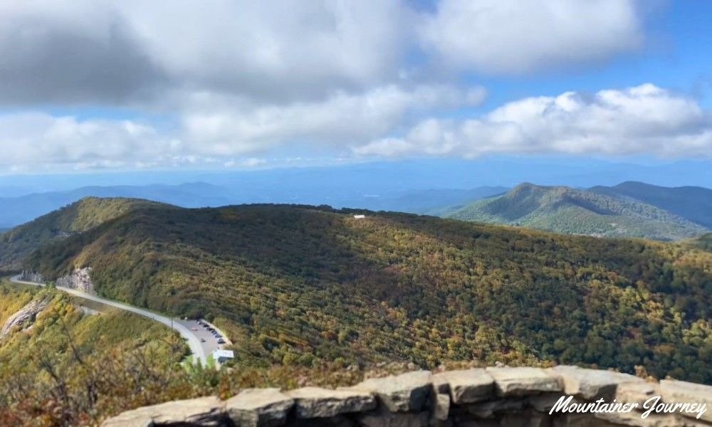
The summit is exposed and can feel much colder and windier than downtown Asheville. Bring a light layer even when the city forecast appears warm.
Practical tip: Restrooms are generally available near the Craggy Gardens Visitor Center rather than at the upper trailhead, so plan your pit stops before parking.
2. Mount Pisgah Trail
Best for: Active hikers wanting a short but satisfying summit climb.
Distance: 3.2 miles round trip
Difficulty: Moderate to strenuous
Trail type: Out-and-back
Nearest base: Asheville
Parking: Mount Pisgah parking area (Milepost 407.6)
Dogs: Allowed on leash
Mount Pisgah is one of the best short summit workouts near Asheville. The trail climbs 1.6 miles to the summit, gaining more than 700 feet of elevation.
The opening section rises through the forest at a manageable grade, but the second half becomes steeper, rockier, and physically demanding. Hikers expecting an easy walk may find the sustained climb surprising. A communications tower occupies part of the summit, but the surrounding views still make the climb incredibly worthwhile.
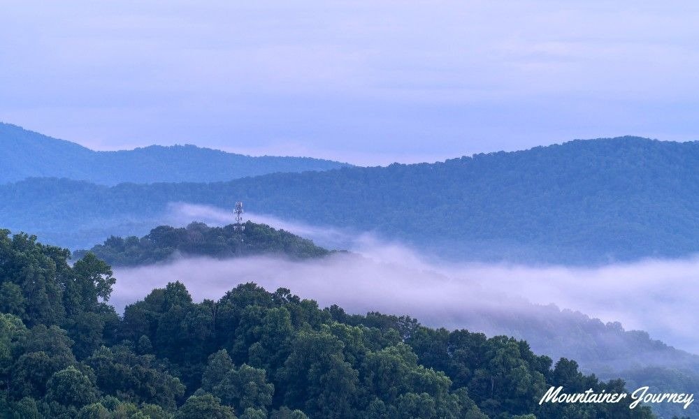
Trekking poles can significantly reduce pressure on the knees during the rocky descent, especially for hikers who are not used to steep mountain trails.
Practical tip: Combine this hike with a stop at the Pisgah Inn for lunch, located right near the trailhead parking area.
3. Black Balsam Knob via the Art Loeb Trail
Best for: Sunrise views, photography, and hikers who prefer open ridges.
Distance: 1.4–2 miles round trip
Difficulty: Moderate
Trail type: Out-and-back
Nearest base: Brevard / Asheville
Parking: Marked roadside spaces along Forest Service Road 816
Dogs: Allowed on leash
Black Balsam Knob is one of the best hikes near Asheville for open mountain scenery. Unlike many forested trails, this route quickly emerges onto a grassy bald with long views in several directions.
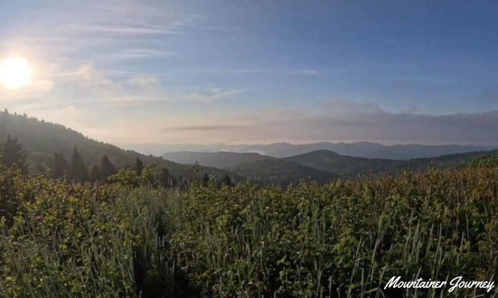
The basic summit hike is short enough for active beginners, but the trail is rocky, uneven, and exposed to rapidly changing weather. Follow the Art Loeb Trail to the summit for a shorter hike, or continue toward Tennent Mountain to create a longer route.
Avoid the open summit when thunderstorms are developing. Lightning can approach quickly at high elevations, even when the weather appears calm at the trailhead.
Practical tip: There is virtually no shade on this hike. Wear sunscreen and a hat, even on cooler days.
4. Bearwallow Mountain Trail
Best for: Sunset views, picnics, and avoiding Blue Ridge Parkway crowds.
Distance: 2 miles round trip
Difficulty: Moderate
Trail type: Out-and-back or partial loop
Nearest base: Gerton / Asheville
Parking: Limited gravel parking at Bearwallow Gap
Dogs: Allowed on leash
Bearwallow Mountain leads to an open summit meadow with broad views over Hickory Nut Gorge. The trail climbs approximately one mile to the summit, and you can return via the same forested route or use a gravel service road to create a simple loop.
The trail is short but features a steady ascent. The summit meadow is actively preserved and often contains grazing cattle, adding a unique charm to your hike.
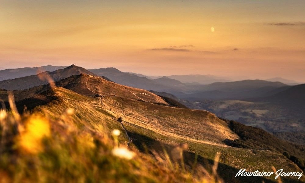
Parking is limited, and access directions require extra attention due to occasional road maintenance in the Gerton area. Check with Conserving Carolina for current access details rather than relying solely on a GPS app.
Practical tip: Keep your dogs strictly leashed and give the grazing cattle plenty of space at the summit.
Best Waterfall Hikes
5. Graveyard Fields Loop and Waterfall Spurs
Best for: Visitors wanting waterfalls and mountain scenery in the same outing.
Distance: 1.2-mile basic loop; 3–4 miles with waterfall spurs
Difficulty: Easy to moderate
Trail type: Loop with out-and-back spurs
Nearest base: Canton / Asheville
Parking: Graveyard Fields Overlook (Milepost 418.8)
Dogs: Allowed on leash
Graveyard Fields combines a high-elevation valley, river scenery, waterfalls, and dense mountain vegetation. The official basic loop is about 1.2 miles and rated easy, but the spur trails leading to the waterfalls are steeper and add considerable mileage.
This distinction matters when planning with children. Someone completing only the main loop will have a very different experience from a visitor trekking to both waterfalls.
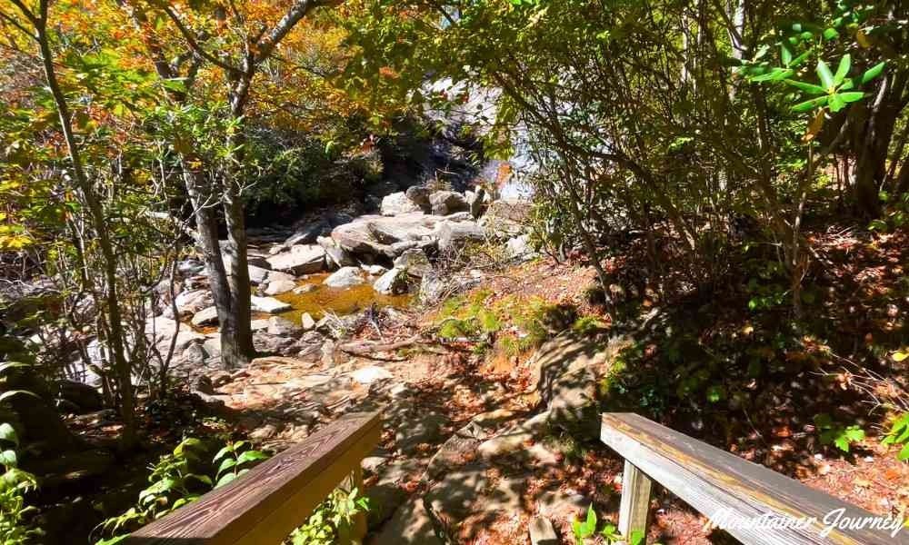
Several informal paths have developed in the area, which can be confusing. Stay on marked trails and always download an offline map before beginning.
Practical tip: The parking lot frequently fills up by 9 AM during summer and fall. Arrive early to avoid creating unsafe roadside parking.
6. Catawba Falls Loop
Best for: A half-day waterfall outing with easier and harder route options.
Distance: 3.5 miles for the complete loop
Difficulty: Moderate
Trail type: Loop
Nearest base: Old Fort / Asheville
Parking: Designated lot at the end of Catawba River Road
Dogs: Allowed on leash
Catawba Falls is one of the most popular waterfall hikes near Asheville. The lower approach follows a broad, gentle route beside the river, leading to an impressive series of cascades.
The full loop is more demanding than the gentle beginning suggests. Recent improvements include hundreds of stairs, several overlooks, and an observation structure connecting visitors to the upper section. The short climb between the lower and upper falls is comparable to climbing a tall building.
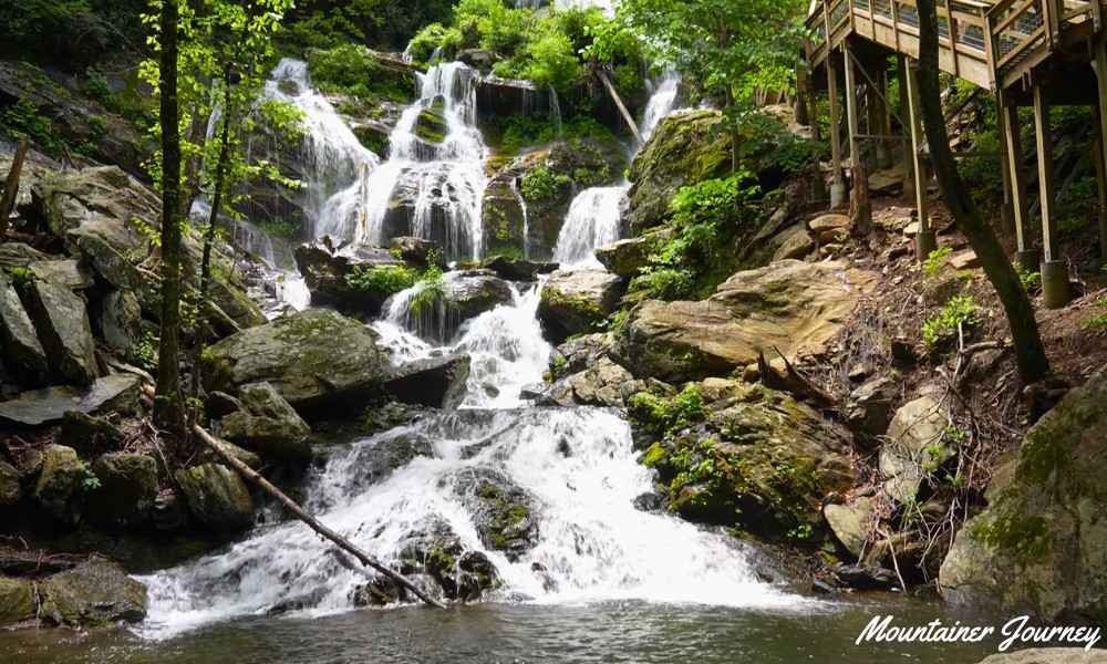
Hikers with mobility concerns may prefer to visit the lower falls and return the same way. Always check the U.S. Forest Service page for the latest trail conditions before visiting.
Practical tip: There is no potable drinking water at the trailhead. Bring enough water in your pack for the entire 3.5-mile loop.
7. DuPont Waterfall Route (Hooker, Triple, and High Falls)
Best for: Families, photographers, and first-time visitors.
Distance: Approximately 3 miles round trip
Difficulty: Moderate
Trail type: Out-and-back
Nearest base: Brevard / Hendersonville
Parking: Hooker Falls Access Area
Dogs: Allowed on leash
The route linking Hooker, Triple, and High Falls provides one of the best multi-waterfall day trips in North Carolina. Located within the DuPont State Recreational Forest, this trail delivers massive scenic payouts.
Hooker Falls requires only a short detour from the parking area. After returning to the main route, hikers cross a pedestrian bridge and continue uphill toward the massive Triple Falls and High Falls. Most of the route follows broad, well-traveled paths, but the climb toward Triple Falls will raise your heart rate.
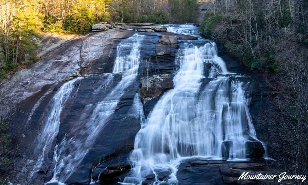
Water levels are stronger after rain, but rocks around waterfalls become extremely slippery. Stay behind all wooden barriers and use established viewing areas.
Practical tip: Arrive before 9 AM or after 5 PM during the summer to secure a spot in the official parking lots.
8. Moore Cove Falls Trail
Best for: Beginner hikers, families, and short Pisgah National Forest stops.
Distance: 1.4 miles round trip
Difficulty: Easy
Trail type: Out-and-back
Nearest base: Brevard
Parking: Roadside pull-off on US 276
Dogs: Allowed on leash
Moore Cove Falls is arguably the easiest waterfall hike near Asheville, making it a perfect choice for families and occasional hikers.
The trail crosses a creek using small footbridges and climbs very gradually through a shaded forest. While roots and muddy sections mean the path is not wheelchair accessible, it remains highly manageable for most ages. The trail ends at a 50-foot waterfall that drops beautifully over a rock overhang.
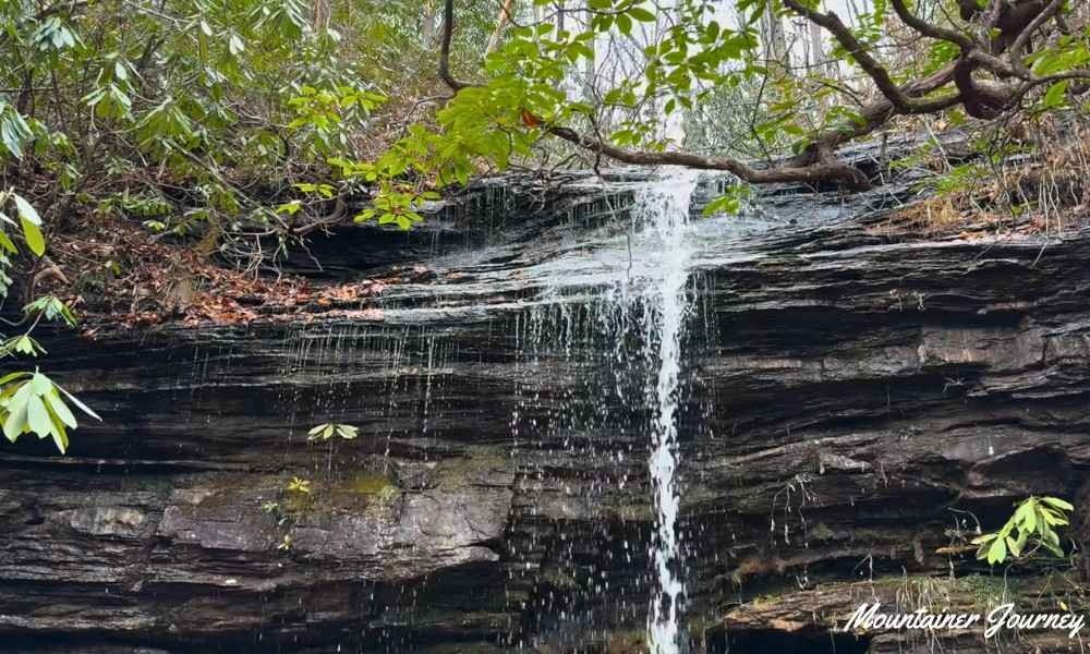
The official trail ends at the observation area. Do not climb above the falls or enter slippery areas around the rock overhang, as wet rocks can cause serious falls.
Practical tip: Water flow here can be a bit light during dry summer months. For the best experience, visit a day or two after heavy rainfall.
Best Forest and Endurance Hikes
9. Pink Beds Loop
Best for: Hikers wanting a relaxed half-day forest walk without mountain ascents.
Distance: Approximately 5.5 miles
Difficulty: Easy to moderate
Trail type: Loop
Nearest base: Brevard
Parking: Pink Beds Picnic Area on US 276
Dogs: Allowed on leash
Pink Beds Loop is one of the best easy hikes around Asheville for people who prioritize distance over steep climbing.
The trail passes through dense forests, open fields, wetlands, and creeks via sections of wooden boardwalks. Its modest elevation change makes it much more approachable than mountain hikes of a similar length.
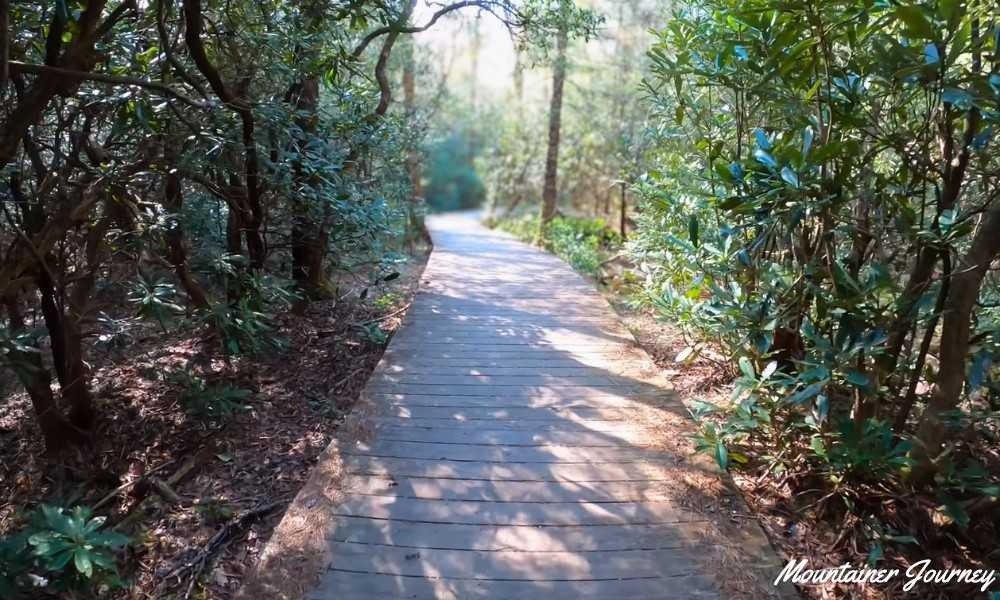
However, easy does not mean quick; a 5.5-mile hike can still take 2 to 3 hours. Boardwalks, roots, and wet ground can become slick after rain. Waterproof hiking footwear is highly recommended during wetter seasons.
Practical tip: The nearby picnic area generally has restrooms but no potable water. Pack all your own drinking water.
10. Looking Glass Rock Trail
Best for: Fit, experienced hikers wanting a challenging half-day climb.
Distance: 6.2 miles round trip
Difficulty: Moderate to Strenuous
Trail type: Out-and-back
Nearest base: Brevard
Parking: Looking Glass Rock Trailhead (FS Road 475)
Dogs: Allowed on leash
Looking Glass Rock is the most demanding trail on this list. It climbs almost continuously through the forest using a long series of relentless switchbacks.
Gaining approximately 1,700 feet over 3.1 miles makes this feel strenuous for occasional hikers. Near the top, hikers reach exposed granite rock with plunging views across Pisgah National Forest. The rock surface slopes sharply and becomes dangerously slick when wet or icy.
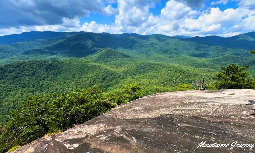
Allow approximately four to five hours, including breaks. If you are unsure about your fitness level, try Mount Pisgah first before attempting this route.
Practical tip: Never cut across switchbacks here. Shortcuts drastically increase trail erosion and are often steeper and more dangerous than the official route.
Best Asheville Trails by Visitor Type
| Visitor Type | Best Option | Why It Fits |
| First-time visitors | Craggy Pinnacle | Short distance, moderate effort, classic Blue Ridge views. |
| Families with kids | Moore Cove Falls | Short, minimal climbing, and a safe viewing area. |
| Couples | Bearwallow Mountain | Beautiful open meadows perfect for a sunset picnic. |
| Beginners | Pink Beds Loop | Flat, scenic, and avoids steep mountain drop-offs. |
| Advanced hikers | Looking Glass Rock | 1,700 feet of elevation gain for a serious physical challenge. |
| Waterfall lovers | DuPont Route | Three powerful, distinct waterfalls in a single 3-mile trek. |
Best Time to Visit Asheville Hiking Trails
- Spring (March – May):
- Pros: Waterfalls (like Catawba and Moore Cove) flow heavily, and wildflowers bloom beautifully.
- Caution: Trails can be incredibly muddy.
- Best Trail: Moore Cove Falls.
- Summer (June – August):
- Pros: High-elevation trails offer a cool escape from the humid city heat.
- Caution: Afternoon thunderstorms are common; lots fill by 9 AM.
- Best Trail: Black Balsam Knob (go early!).
- Fall (September – November):
- Pros: Incredible autumn foliage, especially along the Parkway.
- Caution: This is peak tourist season; expect heavy crowds and traffic.
- Best Trail: Graveyard Fields.
- Winter (December – February):
- Pros: Peaceful trails and unobstructed views through bare winter trees.
- Caution: Ice on trails can be dangerous; Blue Ridge Parkway closures are frequent.
- Best Trail: Bearwallow Mountain.
Asheville Hiking Safety & Practical Tips
- Check Official Pages: Parkway roads and forest trails close frequently for weather or maintenance. Always verify access via the National Park Service (NPS) before leaving your hotel.
- Leave No Trace: Protect these fragile environments. Stick to marked trails, pack out all your trash, and review the 7 Principles of Leave No Trace before hiking.
- Download Offline Maps: Cell service is non-existent on the Parkway and inside Pisgah National Forest. Download your maps on Wi-Fi first.
- Stay Away from Wet Rocks: Rocks near waterfalls are covered in slick algae. Never climb above a waterfall or cross barriers for a photograph; fatalities happen here every year.
- Proper Footwear: Sneakers will slip on wet roots and mud. Wear shoes with deep lugs or proper hiking boots.
Common Mistakes to Avoid
- Choosing by mileage only: Assuming a 2-mile mountain climb is easier than a flat 4-mile walk. Elevation gain matters more than distance!
- Arriving too late: Showing up at DuPont or Graveyard Fields at 11 AM on a Saturday. You will likely not find legal parking.
- Relying on live GPS: Following Apple or Google Maps blindly in the mountains often leads to dead-end dirt roads with no signal to reroute.
- Ignoring the weather: Pushing toward an exposed summit like Black Balsam when you hear thunder in the distance.
Final Verdict
Asheville has enough trail variety that you never need to force the wrong hike into your schedule.
- Best Overall Option: Craggy Pinnacle delivers the ultimate mountain experience with the least amount of driving and climbing.
- Best Beginner Option: Moore Cove Falls is an easy, low-stress introduction to North Carolina’s waterfalls.
- Best Family Option: DuPont State Recreational Forest gives kids three massive waterfalls to look at over a moderate 3-mile walk.
- Best Hard Option: Looking Glass Rock will test your endurance and reward you with breathtaking summit views.
Select a route that matches your fitness, check the road closures, arrive early, and take your time enjoying the beauty of the Blue Ridge Mountains.
Planning a longer Southern Appalachian road trip?
If your travels are taking you further south, compare these Asheville routes with our complete guides to the best hikes in Georgia and the top North Georgia trails to discover even more hidden waterfalls, mountain summits, and scenic day trips.
FAQs About Hiking Trails Around Asheville
What are the best hiking trails around Asheville for first-time visitors?
Craggy Pinnacle is ideal for quick mountain views, while Moore Cove Falls suits beginners. For several waterfalls in one outing, choose DuPont State Recreational Forest.
Which easy hikes around Asheville are suitable for beginners?
Moore Cove Falls is the best short beginner option. The Pink Beds Loop is longer but gentle. The lower section of Catawba Falls also works well if you skip the steep stairs.
What are the best waterfall hikes near Asheville?
The DuPont route offers the most variety with Hooker, Triple, and High Falls. Catawba Falls offers a well-developed adventure, while Moore Cove is best for a short walk.
Which Asheville hikes have the best mountain views?
Craggy Pinnacle offers panoramic views after a short climb. Black Balsam Knob provides open ridgeline scenery, while Bearwallow Mountain combines meadow views with a moderate hike.
Are hiking trails around Asheville free?
Yes, most trails in this guide do not charge an individual hiking fee. You can keep costs low by packing food, carrying water, and using free public trailheads.
When is the best season for hiking near Asheville?
Late spring through fall provides the best access to high-elevation trails. Spring is excellent for waterfalls, while fall brings cooler temperatures and famous autumn foliage.
Do I need an offline map for hikes near Asheville?
Absolutely. Cell service is unreliable around many mountain trails. Download your route before starting and confirm your return path at major trail junctions.
Editorial Note
This guide is designed to help you safely plan your hikes around Asheville, North Carolina, using data from official park and forest authorities.
Trail conditions, road access, and parking change frequently due to weather and busy seasons. This guide supplements, but does not replace, official alerts. Always verify current conditions with local agencies and use your own judgment regarding weather, fitness, and group readiness before hitting the trail.
Written by: Mountainer Journey Editorial Team
Reviewed against: National Park Service, U.S. Forest Service, N.C. Forest Service and Conserving Carolina are official sources.
Last updated: July 2026
Content focus: Asheville trail planning, Blue Ridge Parkway access, waterfall and mountain summit hikes, and practical safety guidance for day hikers