

Introduction
The best North Georgia trails include Dukes Creek Falls, Raven Cliffs Trail, Anna Ruby Falls, Blood Mountain, Brasstown Bald, Bear Hair Gap, Long Creek Falls, Tallulah Gorge Rim Trails and Cloudland Canyon West Rim Loop. For most first-time visitors, Dukes Creek Falls offers the best balance of waterfall scenery, manageable distance, and convenient access from the Helen area.
North Georgia is home to some of the state’s most rewarding hiking experiences. Forest roads climb into the Blue Ridge Mountains, clear creeks run through shaded valleys, and trails lead to waterfalls, rocky summits, lake overlooks and wide Appalachian views.
The region offers plenty of choices, but picking the right trail is not always simple. A short paved route may still involve a steep climb. A two-mile waterfall hike may feel easy on the way down but require a tiring uphill return. Another trail may appear close to town on a map but sit at the end of a slow gravel road.
Your best option depends on where you are staying, how much climbing your group can manage, the type of scenery you want, whether you are traveling with children or dogs, and whether your vehicle is suitable for mountain-road access.
This guide organizes 12 popular North Georgia hiking trails by the nearest mountain towns, making it easier to plan a day around Helen, Blairsville, Hiawassee, Blue Ridge, Clayton, Tallulah Falls or northwest Georgia.
Planning to explore beyond the mountains? Read our complete guide to the best hikes in Georgia for canyon trails, Atlanta-area walks, and hiking destinations across the state.
Last updated: July 2026
Important: Trail distances, parking rules, fees, dog policies, shuttle availability, opening hours, permits and road conditions can change. Always check the latest official park, Forest Service or trail-management page before traveling.
Quick Answers for First-Time Visitors
What is the best North Georgia trail overall?
Dukes Creek Falls is the best all-around choice for many first-time visitors. It combines waterfall scenery, a manageable distance and convenient access from Helen and the Russell-Brasstown Scenic Byway.
What is the easiest waterfall hike in North Georgia?
Anna Ruby Falls is the easiest waterfall option in this guide. The path is short and paved, although the walk toward the viewing platforms is steadily uphill.
Which North Georgia trail has the best mountain views?
Brasstown Bald provides the most accessible high-elevation viewpoint. Blood Mountain and Rabun Bald offer more demanding hiking experiences with rewarding summit scenery.
What is the best North Georgia hike for experienced hikers?
Blood Mountain is the strongest classic summit hike on this list. It combines sustained climbing, rocky footing, Appalachian Trail scenery and broad views near the summit.
Where should first-time visitors stay?
Helen is one of the most convenient hiking bases for a first trip. Anna Ruby Falls, Dukes Creek Falls and Raven Cliffs Trail provide three different waterfall and forest experiences within the same general area.
Are dogs allowed on North Georgia trails?
Many North Georgia trails allow leashed dogs, but rules vary by park and trail. Georgia State Parks generally welcomes leashed dogs on many trails, but there are restrictions at some Tallulah Gorge routes and inside certain facilities. Always check the current pet policy before visiting.
Quick Guide to the Best North Georgia Trails
| Trail | Base | Difficulty | Best For | Access Note |
| Anna Ruby Falls Trail | Helen | Easy to moderate | Families and short visits | Paved but uphill |
| Raven Cliffs Trail | Helen | Moderate | Forest and creek scenery | Parking fills early |
| Dukes Creek Falls Trail | Helen | Moderate | First-time waterfall hikers | Uphill return |
| Bear Hair Gap Trail | Blairsville | Moderate | Lake and mountain views | Starts in Vogel State Park |
| Brasstown Bald Summit Trail | Hiawassee | Moderate but steep | High viewpoint | Shuttle may operate |
| Blood Mountain | Blairsville | Hard | Classic summit hiking | Limited parking |
| Aska Trail System | Blue Ridge | Easy to strenuous | Flexible trail choices | Shared with bikers |
| Long Creek Falls Trail | Blue Ridge/Suches | Easy to moderate | Short A.T. waterfall hike | Gravel-road access |
| Tallulah Gorge Rim Trails | Tallulah Falls | Moderate | Gorge overlooks | Uneven surfaces |
| Rabun Bald via Beegum Gap | Clayton/Dillard | Moderate to hard | Quiet summit scenery | Remote access |
| Fort Mountain Stone Tower Loop | Chatsworth/Ellijay | Moderate | History and sunset views | State park access |
| Cloudland Canyon West Rim Loop | Rising Fawn | Moderately strenuous | Full canyon scenery | Rocky/rooty trail |
Trail distances, fees, shuttle availability, opening hours and road conditions may change. Check the latest official trail map and current alerts from Georgia State Parks or the Chattahoochee-Oconee National Forest before traveling.
How We Selected These North Georgia Trails
These trails were selected using five practical factors:
- Quality and variety of scenery
- Accessibility from popular mountain towns
- Suitability for day hikers
- Range of difficulty levels
- Overall effort-to-reward ratio
The list intentionally includes different types of hikes rather than twelve similar mountain trails. You will find paved waterfall walks, shaded creek routes, Appalachian Trail sections, state park loops, rocky summit climbs, lake overlooks and canyon viewpoints.
Where possible, this guide prioritizes official park, Forest Service and trail-management information for access, safety, fees and restrictions. Conditions can change because of heavy rain, fallen trees, seasonal operations, maintenance work, road damage or temporary closures.
Always confirm current information with the managing park or Forest Service office shortly before your trip.
How to Choose the Right North Georgia Trail
Start with the town where you are staying. Mountain roads are often slower than they appear on a map, so two trails that look close may not fit comfortably into the same day.
Visitors staying in Helen have convenient access to Anna Ruby Falls, Raven Cliffs Trail and Dukes Creek Falls.
Blairsville and Hiawassee are better bases for Blood Mountain, Vogel State Park and Brasstown Bald.
Blue Ridge works well for the Aska Trail System and Long Creek Falls, while Clayton and Dillard place you closer to Rabun Bald and Tallulah Gorge.
Next, decide what type of scenery matters most. Choose a waterfall trail after periods of rainfall when streams are flowing strongly. Select a summit hike when the forecast is clear enough for long-distance views. During warm weather, shaded forest and creek trails may be more comfortable than exposed climbs.
Road access also matters. Developed state parks usually have clearer parking arrangements and maintained approach roads. Some national forest trailheads require driving on gravel roads that may become rough after storms.
Finally, do not judge difficulty by distance alone. Brasstown Bald is short but steep. Rabun Bald gains elevation quickly. Blood Mountain requires sustained climbing and rocky footing despite being manageable as a half-day hike for conditioned visitors.
| Choose This If You Want | Best Trail |
| Easy waterfall walk | Anna Ruby Falls |
| Best first waterfall hike | Dukes Creek Falls |
| Longer forest and creek hike | Raven Cliffs Trail |
| Classic summit challenge | Blood Mountain |
| High viewpoint without a long hike | Brasstown Bald |
| Flexible trail options near Blue Ridge | Aska Trail System |
| Major gorge views | Tallulah Gorge Rim Trails |
| Full canyon scenery | Cloudland Canyon West Rim Loop |
North Georgia Trails Near Helen
1. Anna Ruby Falls Trail
Best for: Families, couples and short scenic walks
Distance: About 0.8 mile round trip
Difficulty: Easy to moderate
Trail type: Out and back
Nearest base: Helen
Parking: Visitor-area parking is available, but it can fill during summer weekends and fall-color season.
Dogs: Leashed dogs may be allowed in outdoor areas, but always check the current recreation-area rules before visiting.
Anna Ruby Falls is one of the most approachable waterfall walks near Helen and Unicoi State Park. The maintained path follows Smith Creek through a shaded forest before reaching viewing platforms below the twin waterfalls.
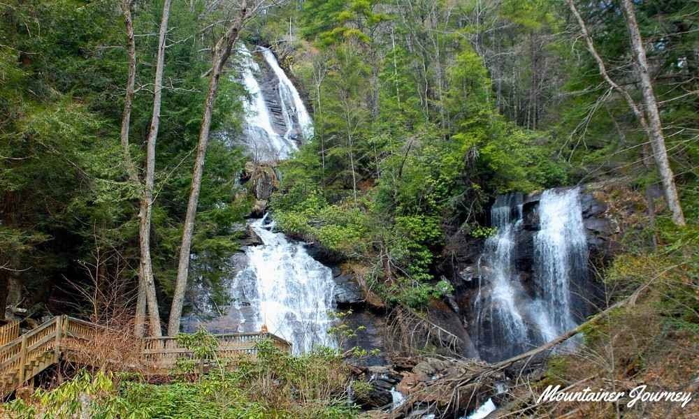
The trail is paved, but that does not mean it is completely effortless. The official recreation-area information describes the path as a 0.4-mile paved foot trail from the visitor center to the observation decks, with some short, steep sections along the way.
Visitors pushing a stroller or traveling with relatives who have limited mobility should allow additional time. Railings, viewing platforms and a clearly defined route make Anna Ruby Falls easier to navigate than most natural-surface hiking trails in North Georgia.
It works particularly well as a first stop, a family outing or a short walk before spending time in Helen. However, the trail can feel crowded during summer weekends and the fall-color season.
Choose this trail if: You want a short, maintained waterfall walk close to Helen.
Keep in mind: The path is uphill toward the falls, and popular visiting periods can become busy.
Planning tip: Arrive near opening time and combine the walk with Unicoi State Park or the Russell-Brasstown Scenic Byway.
2. Raven Cliffs Trail
Best for: A longer forest hike with creek scenery
Distance: About 5 miles round trip
Difficulty: Moderate
Trail type: Out and back
Nearest base: Helen
Parking: Trailhead parking is limited and may fill early on pleasant weekends.
Dogs: Usually allowed on leash, but mud, creek crossings and slippery rocks can make the route harder for pets.
Raven Cliffs Trail offers a more immersive hiking experience than the shorter viewing-platform trails around Helen.
The route follows Dodd Creek through a green mountain valley. Smaller cascades, moss-covered rocks and flowing water remain visible during much of the hike.
Near the end of the trail, Raven Cliff Falls passes through a split in a large rock formation, giving it a different appearance from the more open waterfalls found elsewhere in North Georgia.
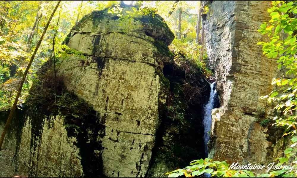
Most of the route is not extremely steep, but roots, mud and wet stones can make the walk tiring after rain. The area near the waterfall is also not suitable for climbing or scrambling on wet rock.
Raven Cliffs Trail works well for couples, older children and beginners ready to progress beyond short paved walks.
Choose this trail if: You want several hours in the forest with frequent creek and cascade views.
Keep in mind: Wet roots and rocks can become slippery, and the parking area may fill early.
Access note: Keep Dukes Creek Falls or another nearby route as a backup during pleasant weekends.
3. Dukes Creek Falls Trail
Best for: First-time hikers who want a proper waterfall trail
Distance: About 2.2 miles round trip
Difficulty: Moderate
Trail type: Out and back
Nearest base: Helen
Parking: Paid day-use parking may apply; check current Forest Service fee details before going.
Dogs: Usually allowed on leash, but verify current recreation-area rules before visiting.
Dukes Creek Falls offers one of the best effort-to-scenery ratios near Helen.
The trail begins near the Russell-Brasstown Scenic Byway and descends through the forest toward platforms overlooking the waterfall and gorge.
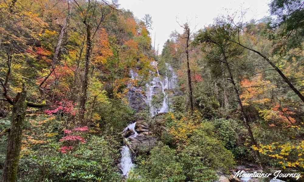
The Forest Service describes Dukes Creek Falls Recreation Area as a moderate hiking trail with exceptional scenery along the Russell-Brasstown National Scenic Highway.
The outward journey may feel comfortable because much of it goes downhill. However, visitors should save energy for the steady climb back to the parking area.
Dukes Creek provides more of a traditional forest hiking experience than Anna Ruby Falls without requiring the longer distance of Raven Cliffs Trail.
That combination makes it a sensible choice for first-time visitors and active families comfortable with uneven surfaces and a moderate return climb.
Choose this trail if: You want the best balance of waterfall scenery, distance and manageable effort.
Keep in mind: The more tiring part of the hike comes at the end.
Planning tip: Carry water even in cool weather because the return climb often feels harder than expected.
Trails Near Blairsville and Hiawassee
4. Bear Hair Gap Trail at Vogel State Park
Best for: A moderate forest loop with a lake overlook
Distance: About 4.1 miles
Difficulty: Moderate
Trail type: Partial loop
Nearest base: Blairsville
Parking: Parking is available inside Vogel State Park; a Georgia ParkPass may be required.
Dogs: Usually allowed on leash, but check current park rules and keep pets controlled on narrow natural-surface sections.
Bear Hair Gap is a useful alternative for hikers who want mountain scenery without choosing one of the region’s steepest summit climbs.
The route begins inside Vogel State Park and climbs through a wooded mountain landscape. Its main reward is an elevated view over Lake Trahlyta and the surrounding ridges.
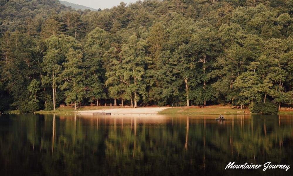
Georgia State Parks lists Bear Hair Gap Trail as a 4.1-mile partial loop with moderate difficulty, natural surface and foot travel only.
The trail includes inclines, natural surfaces and uneven sections. However, the loop format gives it a different rhythm from a direct out-and-back summit hike.
Bear Hair Gap is long enough to feel like a proper woodland outing while remaining manageable for many active visitors.
Families with young children may be more comfortable on Vogel’s lake loop and around Trahlyta Falls. Bear Hair Gap is better for adults, older children and active families comfortable with several miles of continuous walking.
Choose this trail if: You want a moderate forest loop and lake views without tackling a major summit.
Keep in mind: It is not the easiest family trail inside Vogel State Park.
Planning tip: Pick up or download the current park trail map because Vogel connects with several longer backcountry routes.
5. Brasstown Bald Summit Trail
Best for: Reaching Georgia’s highest point without a long hike
Distance: About 1.2 miles round trip
Difficulty: Moderate because of the steep grade
Trail type: Out and back
Nearest base: Hiawassee or Blairsville
Parking: Paid visitor-area parking or admission may apply; check current hours, fees and shuttle availability.
Dogs: Leashed dogs may be allowed outside, but they are not allowed inside visitor facilities. Verify current rules before visiting.
Brasstown Bald rises 4,784 feet above sea level and provides one of the most accessible high-elevation viewpoints in Georgia. The Forest Service identifies Brasstown Bald as the highest point in Georgia.
The summit trail covers only about 0.6 mile each way, but it climbs steeply from the parking area toward the visitor center and viewing platform.
The paved surface makes navigation straightforward. However, the sustained incline can surprise visitors expecting a relaxed walk because of the short distance.
At the summit, the observation area provides layered mountain views that may extend far beyond North Georgia when the weather is clear.

A seasonal shuttle may provide an alternative for visitors who cannot comfortably manage the climb. Conditions at the summit can also feel cooler and windier than they do in Blairsville or Hiawassee.
Choose this trail if: You want a major mountain viewpoint without committing to a long backcountry hike.
Keep in mind: Short distance does not mean an easy climb.
Planning tip: Carry a light outer layer during spring, fall and winter, even when nearby towns feel comfortable.
6. Blood Mountain via Byron Herbert Reece Trail
Best for: A classic North Georgia summit challenge
Distance: About 4.3 miles round trip
Difficulty: Hard
Trail type: Out and back
Nearest base: Blairsville
Parking: Limited designated parking is available near the Byron Herbert Reece trailhead; arrive early on busy weekends.
Dogs: Usually allowed on leash, but steep, rocky terrain can be difficult for some dogs.
Blood Mountain is one of the most recognized North Georgia hiking destinations and the highest point along Georgia’s section of the Appalachian Trail.
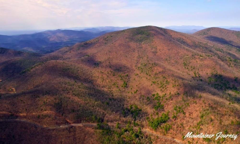
The common day-hike route begins near the Byron Herbert Reece trailhead. The blue-blazed connector trail climbs from the parking area toward an Appalachian Trail junction, where hikers can continue toward the top of Blood Mountain.
Expect steady elevation gain, exposed roots and increasingly rocky terrain near the top. Open rock areas around the summit provide broad mountain views, while the historic stone shelter adds to the trail’s Appalachian character.
Blood Mountain is relatively short compared with many summit hikes, but it is not an ideal first trail for visitors accustomed only to flat paths.
The combination of climbing, rocky footing and changing weather demands more energy than the mileage suggests.
Choose this trail if: You want a classic Appalachian summit hike and are comfortable with steep, rocky terrain.
Keep in mind: This is one of the most physically demanding trails in the guide.
Access note: Parking is limited. Start early during spring and fall weekends and follow all roadside parking rules.
Hiking Trails Near Blue Ridge
7. Aska Trail System
Best for: Visitors who want several route choices near Blue Ridge
Distance: Individual routes range from about 1 to 5.1 miles
Difficulty: Easy to strenuous
Trail type: Connected trail network
Nearest base: Blue Ridge
Parking: Parking depends on the chosen trailhead; download the official map before leaving town.
Dogs: Usually allowed on leash, but hikers should watch for mountain bikers.
The Aska Trail System is not one individual hike. It is a network of interconnected recreational trails where visitors can choose a route according to their time, interests and fitness level.
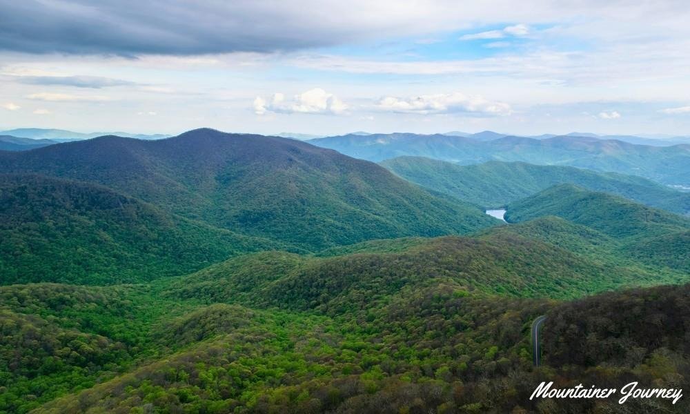
The Forest Service describes the Aska Trail System as approximately 17 miles of recreational trails for hikers and bicyclists, located less than ten miles from downtown Blue Ridge. Routes range from 1.0 mile to 5.1 miles and vary from easy to strenuous.
Some routes follow old logging roads, while others use narrower hand-built paths. Portions of the network also connect with the Benton MacKaye Trail.
This flexibility makes Aska particularly useful for repeat visitors. One person may choose a short forest walk, while another can plan a longer and more demanding route.
The trails are also used by mountain bikers. Hikers should remain alert, listen for approaching riders and avoid stopping around blind corners.
Choose this trail system if: You want flexible route options near Blue Ridge rather than one fixed destination.
Keep in mind: Navigation is more important in a trail network than on a simple out-and-back path.
Planning tip: Download the official map before leaving town and decide on your intended route before starting.
8. Long Creek Falls Trail
Best for: A short waterfall hike on part of the Appalachian Trail
Distance: About 1.8 to 2 miles round trip
Difficulty: Easy to moderate
Trail type: Out and back
Nearest base: Blue Ridge or Suches
Parking: Limited parking is available near the Three Forks area; access roads can be gravel and rough after storms.
Dogs: Usually allowed on leash, but check current trail conditions and keep pets controlled near water.
Long Creek Falls sits near Three Forks and is reached by walking a short section of the Appalachian Trail.
The Appalachian Trail Conservancy describes the route from Forest Service Road 58 at Three Forks as a gentle A.T. walk, with a blue-blazed side trail leading to Long Creek Falls after about 0.8 mile.
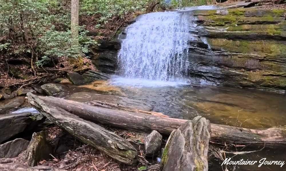
The hiking distance is manageable for many visitors, making this a convenient way to experience part of the Appalachian Trail without committing to a long summit climb.
The main planning challenge is often the approach rather than the trail itself. The trailhead is reached by a gravel Forest Service road that may feel uncomfortable in a low-clearance vehicle, particularly after rough weather.
Allow more driving time than the distance from Blue Ridge might suggest.
Choose this trail if: You want a short waterfall walk and a small taste of the Appalachian Trail.
Keep in mind: The access road may be slower and rougher than expected.
Access note: Check recent road conditions before leaving and do not treat standard map-estimated driving time as exact.
Trails Near Clayton and Tallulah Falls
9. Tallulah Gorge Rim Trails
Best for: Major gorge views without descending hundreds of stairs
Distance: About 3 miles round trip
Difficulty: Moderate
Trail type: Rim route
Nearest base: Tallulah Falls or Clayton
Parking: Parking is available inside Tallulah Gorge State Park; a Georgia ParkPass may be required.
Dogs: Leashed pets are welcome on rim trails, but pets are not allowed on the gorge floor, Sliding Rock Trail or Hurricane Falls staircase to the suspension bridge.
The rim trails at Tallulah Gorge connect several viewpoints above one of Georgia’s most dramatic landscapes.
Instead of descending toward the gorge floor, this route remains along the upper edges. That makes it a better choice for visitors who want impressive views without committing to the more demanding stair routes.
Georgia State Parks lists the North and South Rim Trails as about 3 miles round trip, with a mulched surface, exposed roots and a moderate rating.
The surface still includes roots, inclines and uneven sections. Several overlooks reveal different angles of the gorge, river and waterfalls, so it is worth continuing beyond the first viewpoint.
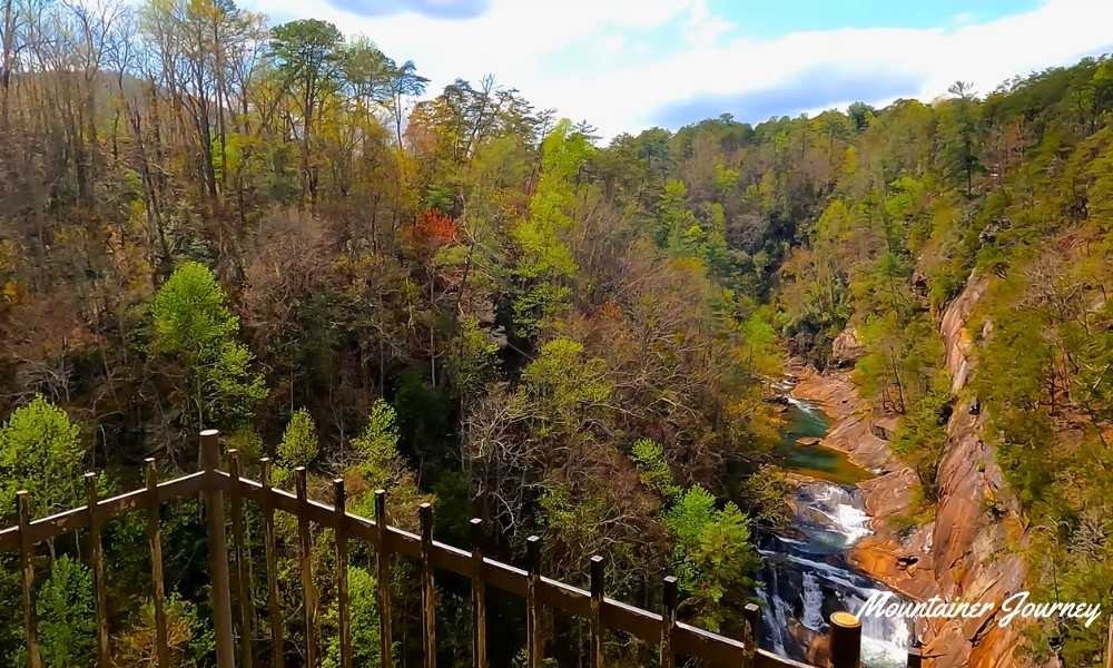
The rim trails work particularly well for couples, photographers and mixed-ability groups.
Visitors uncomfortable near heights should remain behind barriers and avoid stepping toward unprotected edges for photographs.
Gorge-floor access follows separate rules. Free permits may be required and are limited, so do not confuse rim-trail hiking with gorge-floor access.
Choose this trail if: You want major canyon scenery without completing the difficult stair descent.
Keep in mind: Remaining on the rim does not make the entire route flat or paved.
Planning tip: Gorge-floor access follows separate rules and should not be confused with the standard rim trails.
10. Rabun Bald via Beegum Gap
Best for: A quieter high-elevation summit hike
Distance: About 3 miles round trip
Difficulty: Moderate to hard because of the steep climb
Trail type: Out and back
Nearest base: Clayton or Dillard
Parking: Parking is limited and access feels more remote than developed state-park routes.
Dogs: Usually allowed on leash, but the climb is steep and may be tiring for some pets.
Rabun Bald is one of Georgia’s highest peaks and a strong option for hikers seeking a mountain climb away from the state’s most developed viewpoints. Forest Service map resources identify Rabun Bald at 4,696 feet above sea level.
The route from Beegum Gap follows part of the Bartram Trail and begins gaining elevation quickly.
Its short distance can make the hike appear moderate on paper. However, the sustained climb creates a demanding workout.
A wooden observation platform at the summit provides wide views across the mountains of Georgia and North Carolina.
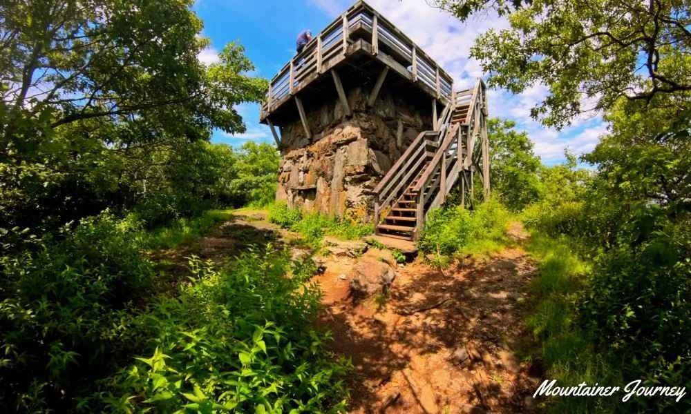
The trailhead feels more remote than Brasstown Bald or most state park routes. Visitors should download directions, carry an offline map and avoid depending entirely on mobile service.
Choose this trail if: You want a quieter summit experience and are prepared for a steep climb.
Keep in mind: The short mileage does not reflect the intensity of the ascent.
Planning tip: Choose a clear morning because low clouds can hide much of the surrounding mountain scenery.
Northwest Georgia Mountain Trails
11. Fort Mountain Stone Tower Loop
Best for: History, mountain views and a shorter outing
Distance: About 1 mile
Difficulty: Moderate
Trail type: Loop
Nearest base: Chatsworth or Ellijay
Parking: Parking is available inside Fort Mountain State Park; a Georgia ParkPass may be required.
Dogs: Usually allowed on leash, but check current park rules and keep pets controlled near steps and overlooks.
Fort Mountain combines mountain scenery with two unusual historical landmarks: a stone fire tower built by the Civilian Conservation Corps and an old stone wall whose original purpose remains uncertain.
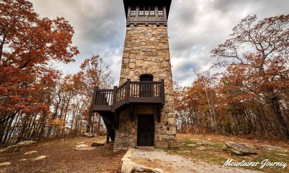
Georgia State Parks describes the Stone Tower Loop as a route that travels uphill on the West Overlook Trail and returns on the CCC Stone Tower Trail. The trail includes year-round views from West Overlook, natural rock gardens and CCC-built steps.
The route provides a satisfying mountain walk without requiring most of the day.
The western overlook is particularly attractive during late-afternoon light, while the tower and stone wall give the hike more historical interest than a standard viewpoint trail.
Visitors seeking a longer challenge can consider other routes inside Fort Mountain State Park, including the much more demanding Gahuti Trail.
Choose this trail if: You want a shorter mountain walk that combines scenery with local history.
Keep in mind: The route still includes uphill and uneven sections.
Planning tip: Do not begin close to sunset unless you have enough daylight and a reliable light for the return.
12. Cloudland Canyon West Rim Loop
Best for: A complete canyon hiking experience
Distance: 5 miles round trip
Difficulty: Moderately strenuous
Trail type: Lollipop-style loop
Nearest base: Rising Fawn
Parking: Parking is available inside Cloudland Canyon State Park; a Georgia ParkPass may be required.
Dogs: Usually allowed on leash, but rocky, rooty terrain and longer mileage may be tiring for some dogs.
The West Rim Loop is a strong choice for visitors who care more about broad canyon scenery than about reaching the base of a waterfall.
The route begins with a shared approach before forming a loop along the western side of Cloudland Canyon.
Georgia State Parks describes the West Rim Loop Trail as a 5-mile round-trip, moderately strenuous lollipop-style hike with several scenic viewpoints of Cloudland Canyon. The official trail information also notes rocky and rooty sections.
Rocky ground, exposed roots and rolling elevation make it more demanding than an easy park walk. However, the effort is spread across several miles rather than concentrated into one large staircase.
Multiple viewpoints look across the canyon and surrounding ridges. The trail is particularly attractive during fall, although that is also when parking areas and overlooks become busiest.
Do not turn around after the first viewpoint. Completing the full loop provides a better understanding of the canyon’s size and changing landscape.
Choose this trail if: You want one of the most complete canyon hikes in North Georgia.
Keep in mind: Five miles of roots, rocks and rolling terrain require more time than an easy five-mile walk.
Planning tip: Allow enough time for the complete loop and carry water even during cooler weather.
Best North Georgia Trail for Every Type of Visitor
| Visitor Need | Best Trail | Why It Fits |
| Best overall for first-time visitors | Dukes Creek Falls | Good balance of waterfall scenery, distance and manageable effort |
| Best short waterfall walk | Anna Ruby Falls | Short, paved and easy to navigate |
| Best longer waterfall hike | Raven Cliffs Trail | More time in the forest with creek and cascade views |
| Best trail network near Blue Ridge | Aska Trail System | Multiple route options for different fitness levels |
| Best easy family outing | Anna Ruby Falls or Vogel Lake Loop | Easier than steep summit or canyon routes |
| Best for active families with older children | Bear Hair Gap Trail | Moderate forest loop with lake and mountain views |
| Best accessible high viewpoint | Brasstown Bald | Major mountain views without a long backcountry hike |
| Best classic summit challenge | Blood Mountain | Appalachian Trail scenery, rocky terrain and broad summit views |
| Best quieter mountain summit | Rabun Bald | More remote and less developed than Brasstown Bald |
| Best gorge overlook experience | Tallulah Gorge Rim Trails | Big views without descending to the gorge floor |
| Best full canyon hike | Cloudland Canyon West Rim Loop | Longer canyon route with several viewpoints |
| Best history and scenery combination | Fort Mountain Stone Tower Loop | Mountain views with CCC history and stone landmarks |
| Best short Appalachian Trail experience | Long Creek Falls | Short waterfall hike using part of the Appalachian Trail |
Families should compare terrain rather than distance alone. A short, steep climb may be harder for children than a longer forest loop.
Mixed-ability groups may be more comfortable in developed parks where family members can choose different routes and meet afterward.
Best Time for Hiking in North Georgia
| Season | Best For | Main Concern |
| Spring | Waterfalls, wildflowers and mild temperatures | Rain, mud and slippery roots |
| Summer | Shaded creek and forest trails | Heat, humidity and afternoon storms |
| Fall | Mountain color and cooler weather | Crowds and full parking areas |
| Winter | Clear summit views and fewer visitors | Ice, wind and shorter daylight |
Weather can change quickly in the mountains, so always check the forecast and official park alerts before starting your hike.
Spring
Spring is one of the best seasons for waterfall hikes because regular rainfall can improve water flow. Temperatures are often comfortable, although muddy ground and slippery roots are common.
This is a strong time for Anna Ruby Falls, Dukes Creek Falls, Raven Cliffs Trail and Long Creek Falls.
Summer
Summer hiking is more comfortable when you begin early and choose shaded forest or creek trails. Heat, humidity and afternoon thunderstorms can make exposed summit routes less enjoyable.
Avoid starting exposed or steep climbs during the hottest part of the day. Carry more water than you think you need, especially on Blood Mountain, Rabun Bald, Brasstown Bald and Cloudland Canyon.
Fall
Fall is the most popular season for hiking in North Georgia. Cooler weather and changing mountain color attract large crowds to Brasstown Bald, Vogel State Park, Cloudland Canyon, Fort Mountain and the Helen area.
Start early and keep a backup trail in case your first parking area is full.
Winter
Winter can provide excellent visibility from mountain viewpoints. However, shaded rock, stairs, bridges and mountain roads may become icy.
Always check the forecast for the actual mountain area rather than relying only on weather conditions in the nearest town.
Practical North Georgia Trail-Planning Tips
Download the map before leaving town
Mobile service can weaken quickly in forest and mountain areas. Save the official trail map, parking location and driving directions before beginning your trip.
The Chattahoochee-Oconee National Forest recommends using official visitor maps and GeoPDF maps that can be saved for offline navigation.
If you are hiking a longer or less familiar route, note key junctions in advance and tell someone your plan before you leave.
Check the trailhead road
Not every trailhead is reached by a smooth paved road. Long Creek Falls, Rabun Bald and other remote forest routes require more access planning than trails inside developed state parks.
After heavy rain, gravel roads may become slower, rougher or less comfortable for low-clearance vehicles.
Keep a backup trail nearby
Popular parking areas may fill by late morning during spring and fall weekends. Choose a second trail in the same general area before leaving.
For example, visitors near Helen can keep Anna Ruby Falls, Dukes Creek Falls and Raven Cliffs Trail as flexible options depending on time, parking and group energy.
Plan one main hike per day
Mountain roads are slower than they appear on a map. One main trail, a scenic drive and a short nearby stop usually create a better day than rushing between several distant locations.
This matters especially when combining places around Helen, Blue Ridge, Blairsville, Clayton and northwest Georgia.
Stay away from waterfall rocks
Wet rock near waterfalls is extremely slippery. Remain on established paths, platforms and viewing areas instead of climbing beside or above moving water.
The Forest Service warns visitors never to climb on or around waterfalls and never to play in the water above a waterfall because rocks can be slippery and currents can be swift.
Carry more water than expected
Steep climbs and humid conditions can make even short hikes tiring. Carry enough water for the return journey rather than only the outward walk.
This is especially important on trails where the return climb is harder, such as Dukes Creek Falls, Brasstown Bald, Blood Mountain and Rabun Bald.
Check dog rules before bringing pets
Dog rules vary by park, trail and facility. Some trails welcome leashed dogs, while certain gorge-floor routes, stair sections, buildings, swimming areas or protected areas may restrict pets.
Always check the current pet policy before bringing a dog, especially at Tallulah Gorge.
Pack basic hiking essentials
For longer or less familiar trails, carry water, snacks, a small first-aid kit, rain protection, sun protection, a headlamp, offline maps and an extra layer.
Short hikes can still become difficult when weather changes, daylight runs out or the return climb is harder than expected.
Check current alerts
Storm damage, road work, trail maintenance and seasonal operations can affect access. Verify conditions through the managing park or Forest Service office shortly before traveling.
Common Mistakes to Avoid
- Choosing a hike only because it is short: Brasstown Bald and Rabun Bald gain elevation quickly, while Blood Mountain is physically demanding despite fitting into a half-day schedule for experienced hikers.
- Ignoring the return journey: Dukes Creek Falls begins with a descent, which means the more tiring climbing comes near the end.
- Underestimating gravel-road driving time: A short hike reached by a slow gravel road may require more total time than a longer trail inside a developed park.
- Trying to combine too many distant trails in one day: North Georgia roads are scenic, but they are not always fast.
- Starting too late during busy seasons: Popular trailheads near Helen, Brasstown Bald, Vogel State Park and Cloudland Canyon can become crowded during fall weekends.
- Forcing a hike when conditions are bad: If the parking area is full or the weather has deteriorated, using a nearby alternative is safer than parking illegally or beginning an exposed route before a storm.
- Wearing smooth everyday shoes: Wet roots, muddy paths, loose rock and steep grades require better grip than casual sneakers usually provide.
- Bringing dogs without checking rules: Some trails are dog-friendly, but others have restrictions or terrain that may be difficult for pets.
Final Verdict
The best North Georgia trails depend on where you are staying and the type of hiking day you want.
Stay near Helen for accessible waterfall hikes. Choose Blairsville or Hiawassee for classic mountain routes and high viewpoints. Use Blue Ridge as a base for flexible forest trails and Appalachian scenery. Visit Clayton and Tallulah Falls for gorge landscapes and quieter eastern mountain hikes.
For a first visit, Dukes Creek Falls provides the best combination of scenery and manageable effort.
Choose Raven Cliffs Trail when you want several hours beside a creek and beneath a shaded forest canopy.
Blood Mountain and Rabun Bald are better for hikers looking for a proper summit challenge, while Tallulah Gorge and Cloudland Canyon offer scenery that feels different from the rounded Blue Ridge peaks.
Anna Ruby Falls is the easiest waterfall walk in this guide, while Brasstown Bald is the best choice for visitors who want a major high-elevation view without committing to a long hike.
Wherever you go, match the trail to your group, confirm current access conditions and leave enough time to enjoy the mountain roads instead of rushing between stops.
Frequently Asked Questions
What are the best hiking trails in North Georgia?
Popular options include Dukes Creek Falls, Raven Cliffs Trail, Anna Ruby Falls, Blood Mountain, Brasstown Bald, Tallulah Gorge Rim Trails and Cloudland Canyon West Rim Loop. Choose according to your preferred scenery, difficulty level and nearest mountain town.
Which North Georgia trails have the best waterfalls?
Anna Ruby Falls, Dukes Creek Falls, Raven Cliffs Trail and Long Creek Falls are strong waterfall choices. Anna Ruby Falls is best for a short paved walk, while Raven Cliffs Trail offers a longer forest and creek hike.
Which North Georgia trail has the best mountain views?
Brasstown Bald offers the most accessible high-elevation viewpoint. Blood Mountain and Rabun Bald are better for hikers who want a more demanding climb with rewarding summit views.
Which hike is the hardest in this guide?
Blood Mountain and Rabun Bald are among the hardest hikes in this guide because of steep climbing, rocky sections and elevation gain. Cloudland Canyon West Rim Loop is also tiring because of its length and rocky terrain.
Which trails are best for beginners and families?
Anna Ruby Falls is the easiest option for many families. Dukes Creek Falls is good for active beginners, while Bear Hair Gap Trail suits families with older children who can handle several miles of moderate walking.
When is the best time to hike in North Georgia?
Spring and fall are usually the best seasons. Spring is better for waterfalls and fresh forest growth, while fall offers cooler weather and colorful mountain views. Start early during busy weekends.
Are dogs allowed on North Georgia trails?
Many North Georgia trails allow leashed dogs, but rules vary by park and route. Tallulah Gorge has important pet restrictions on gorge-floor routes and some stair sections, so always check the official policy before bringing a dog.
Do North Georgia trails charge fees or require permits?
Some state parks and recreation areas charge parking or admission fees. Tallulah Gorge rim trails do not require the same permit as gorge-floor access, but gorge-floor access may require a free same-day permit with limited availability.
Where can I find official trail maps?
Download maps from Georgia State Parks, the USDA Forest Service or official trail-management websites. Save maps offline because mobile service can be unreliable in mountain and forest areas.
Can I hike more than one North Georgia trail in a day?
Yes, but it is better to plan one main hike and one nearby short stop. Mountain roads are slower than they look on a map, and popular parking areas can fill during spring and fall weekends.
Editorial Note
This guide was put together to help hikers plan a safe day on North Georgia’s trails. We based it on official information from Georgia State Parks, the USDA Forest Service, and the Appalachian Trail Conservancy.
Trail conditions, parking rules, fees, and road access can change anytime, especially after storms or during busy seasons. This guide isn’t a replacement for official alerts. Always check with the park or Forest Service before you go, and use your own judgment about weather, fitness, and group readiness before starting any hike.
Written by: Mountainer Journey Editorial Team
Reviewed against: Georgia State Parks, USDA Forest Service, and Appalachian Trail Conservancy official sources
Last updated: July 9, 2026
Content focus: North Georgia trail planning, difficulty comparisons, waterfall and summit hikes, and practical safety guidance for day hikers