

Hiking around Chattanooga can mean an easy paved walk beside the Tennessee River, a short climb to a city overlook or a demanding day in a rocky Cumberland Plateau gorge. The right trail depends less on finding one universal “best” hike and more on matching the route to your time, fitness and preferred scenery.
For most first-time visitors, Sunset Rock from Cravens House offers the best balance of mountain views, history and manageable distance. Tennessee Riverwalk is the easiest paved option, Stringer’s Ridge is the most convenient trail network near downtown, and Signal Point to Edwards Point is the stronger choice for experienced hikers seeking a rugged gorge route.
This guide compares 12 hiking places in Chattanooga and the surrounding Tennessee-Georgia area. It covers distance, terrain, parking, dog rules, reservation requirements and the practical details that can change which hike makes sense for your day.
Last updated: August 2026
Important: Trail conditions, access rules, fees, parking arrangements and scheduled closures can change. Check the linked official land-manager page before leaving home.
Editorial Note: How This Guide Was Researched
This research-led guide was prepared using official land-manager and trail-organization sources, including Outdoor Chattanooga, Hamilton County Parks and Recreation, the National Park Service, Cumberland Trail Conservancy, the Tennessee Division of Forestry and Lula Lake Land Trust.
Distances, difficulty, access, parking, fees, reservations and pet rules were checked against those sources. Mountainer Journey does not claim that every trail was personally completed by the editorial team; estimated times are planning ranges, and visitors should confirm current alerts and rules before leaving home.
Quick Answers
What is the best Chattanooga hike overall?
Sunset Rock from Cravens House is the best starting point for many first-time visitors. The route combines a classic Lookout Mountain view with a relatively manageable distance, although the trail is rocky and requires more care than a paved city walk.
What is the easiest hike near Chattanooga?
Tennessee Riverwalk is the easiest option for a flat, paved walk with flexible mileage. For an unpaved beginner route, Poe Run Path at Enterprise South Nature Park is a better introduction to woodland hiking.
What is the best family hike?
Greenway Farm is the most flexible choice for families with younger children because they can stay on the easier park paths. Rainbow Lake offers a more adventurous outing for families comfortable with rocks, uneven footing and a suspension bridge.
Which hike has the best mountain view?
Sunset Rock provides a strong view for a shorter outing. Experienced hikers willing to cover 5.6 rocky miles can continue from Signal Point to Edwards Point for a broader view over the Tennessee River Gorge.
Where can I hike to a waterfall?
Lula Lake Core Preserve has the most destination-style waterfall outing, but it requires a reservation and currently charges a conservation-use fee. Foster Falls is more flexible for a short waterfall visit, while Ritchie Hollow adds a sustained climb.
Chattanooga Hiking Trails at a Glance
| Trail | Distance | Difficulty | Area | Best for |
| Tennessee Riverwalk | Choose your distance: up to 13 miles | Easy | Downtown, St. Elmo and Chickamauga Dam | Paved walking |
| Stringer’s Ridge | Up to 7 miles of trails | Easy to moderate | North Chattanooga | Close-to-downtown views |
| Greenway Farm and Boy Scout Trail | 1.25-mile Boy Scout loop plus park paths | Easy to moderate | Hixson | Flexible family outings |
| Poe Run Path to Hidden Lake | About 3.4 miles round trip | Easy | Enterprise South | Beginners |
| Little Cedar Mountain Main Loop | 3 miles | Moderate | Nickajack Lake | Lake and mountain views |
| Sunset Rock from Cravens House | About 2 miles round trip | Moderate | Lookout Mountain | Classic Chattanooga view |
| Rainbow Lake Loop | 2.3 miles | Moderate | Signal Mountain | Family adventure |
| Signal Point to Edwards Point | 5.6 miles round trip | Strenuous | Signal Mountain | Rugged gorge views |
| Ritchie Hollow Trail | 5.4 miles round trip | Moderately strenuous | Tennessee River Gorge | Waterfall and sustained climb |
| North Chickamauga Creek | 1.4-mile loop or 8.3 miles one way | Moderate to strenuous | Mowbray Mountain | Short or serious route |
| Lula Lake Out and Back | 4.2 miles round trip | Easy by preserve rating | Lookout Mountain, Georgia | Reservation-based waterfall hike |
| Foster Falls and Fiery Gizzard | Short waterfall route or 12 miles point to point | Moderate to strenuous | Near Tracy City | Waterfall or full-day hike |
How to Choose the Right Chattanooga Hike
Start with the amount of time you can realistically spend on the trail. Riverwalk, Stringer’s Ridge, Greenway Farm and Enterprise South allow an early turnaround. Signal Point, Ritchie Hollow and the full Fiery Gizzard require a firmer route plan.
Next, look beyond the distance. A rocky 2.3-mile loop at Rainbow Lake can feel harder than a longer paved walk. Elevation, creek crossings, exposed bluffs and wet rock often matter more than mileage alone.
Families should match the route to the least experienced person in the group. Greenway Farm works well when the group needs flexible terrain. Rainbow Lake suits older children who can manage rocks and uneven steps. Signal Point to Edwards Point should not be selected only because the overlook looks good in photographs.
Finally, check access. Lula Lake requires planning, Sunset Rock has very limited parking at the overlook, and some trails crossing state forests or wildlife-management areas can be affected by hunting schedules.
Easy and In-City Hikes
1. Tennessee Riverwalk
Best for: A paved walk with flexible distance
Official route: Tennessee Riverpark, commonly called the Tennessee Riverwalk
Distance: Choose your distance; the main greenway extends 13 miles.
Estimated time: 30 minutes to several hours
Difficulty: Easy
Trail type: Linear; usually walked as an out-and-back
Nearest base: Downtown Chattanooga
Parking: Multiple official trailheads, including downtown and riverfront access points
Fee or reservation: Free; no hiking reservation
Dogs: Rules vary by segment; pets are prohibited on substantial portions of the Riverwalk.
Official source: Outdoor Chattanooga — Tennessee Riverpark
The Tennessee Riverwalk is the simplest answer for visitors who want scenery without roots, rock steps or a mountain climb. The paved greenway connects downtown Chattanooga with Chickamauga Dam to the east and the St. Elmo area to the south. Multiple access points make it possible to build a walk around the time available.
This is a multi-use route shared with cyclists, runners and skaters. Stay to the right, keep children close and avoid stopping across the full width of the path. The Riverwalk is paved, but bridges, crossings and changes between segments mean visitors with specific accessibility needs should confirm the most suitable trailhead beforehand.
Dog rules are not consistent along the full route. According to Outdoor Chattanooga, pets are not allowed in Coolidge Park or on the Riverwalk from the Bluff View Art District to Chickamauga Dam. Leashed pets are allowed on Walnut Street Bridge and from downtown toward Wheland Foundry.

Practical tip: Pick a landmark or trailhead as your turnaround point before starting; otherwise, an easy one-way stroll can become a much longer return walk.
2. Stringer’s Ridge
Best for: Wooded trails and downtown views without leaving the city
Official route: Stringer’s Ridge trail network
Distance: Up to 7 miles of interconnected trails
Estimated time: 1–3 hours, depending on route
Difficulty: Easy to moderate
Trail type: Trail network with loop options
Nearest base: North Chattanooga
Parking: Spears Avenue trailhead has the larger parking area and restrooms; Old Bell Avenue is the second access point
Fee or reservation: Free; no reservation
Dogs: Allowed on leash
Official source: Outdoor Chattanooga — Stringer’s Ridge
Outdoor Chattanooga describes Stringer’s Ridge as a 92-acre urban wilderness overlooking the North Shore, Tennessee River and downtown Chattanooga. Its seven-mile network makes it easy to adjust the outing instead of committing to one fixed route.
The trails are groomed singletrack with rolling terrain and a few short, steeper sections. Some routes suit casual walkers, while others require more climbing. The overlook near the top is the main objective for first-time visitors and gives the trail a bigger payoff than its city location might suggest.
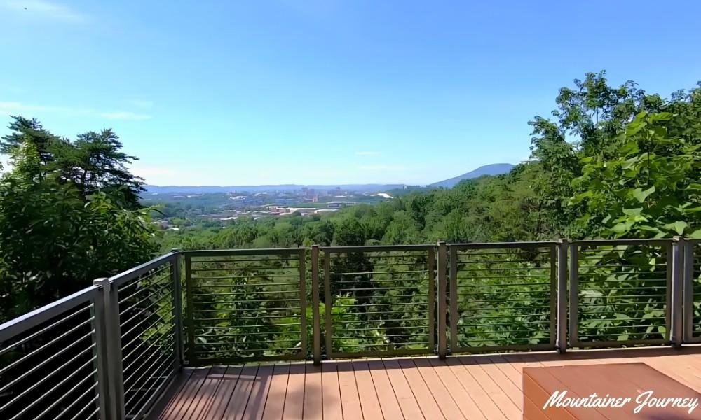
Mountain bikers and pedestrians share parts of the network, so stay alert around bends and follow the posted use signs. After sustained rain, the dirt surface may be muddy even when downtown streets are dry.
Practical tip: Start from Spears Avenue for easier parking, restroom access and a simpler introduction to the trail network.
3. Greenway Farm and Boy Scout Trail
Best for: Families that need both easy paths and a short climb
Official route: Greenway Farm paths and the Boy Scout Trail
Distance: 1.25-mile Boy Scout loop; additional park paths are available
Estimated time: 45–90 minutes for the loop
Difficulty: Easy on the main greenway; moderate on the Boy Scout Trail
Trail type: Mixed park paths and a foot-traffic-only loop
Nearest base: Hixson
Parking: Greenway Farm Park
Fee or reservation: Free; no hiking reservation
Dogs: Leash required outside the fenced-off-leash dog park
Official source: Outdoor Chattanooga — Greenway Farm and North Chickamauga Creek
Greenway Farm gives families more control over the day than most mountain routes. The wider asphalt and crushed-rock greenway is the easier choice, while the Boy Scout Trail adds a 1.25-mile loop on the side of Big Ridge.
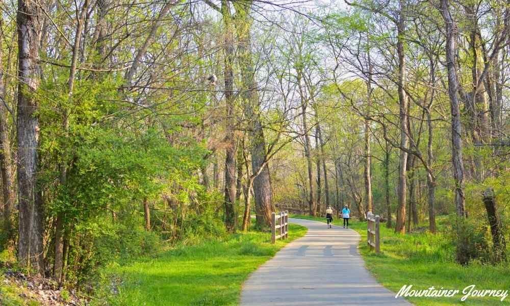
The Boy Scout Trail is short, but it should not be described as flat or effortless. Outdoor Chattanooga identifies it as a steep trek, and it is restricted to foot traffic because it passes through TVA’s sensitive Big Ridge Small Wild Area. Younger children may be happier staying on the main park paths.
The wider park also has creek access, restrooms and a fenced dog park. Dogs must return to a leash everywhere outside that enclosed area.
Practical tip: Begin on the main greenway. Add the Boy Scout loop only after checking that everyone in the group is comfortable with a steeper dirt trail.
4. Poe Run Path to Hidden Lake at Enterprise South
Best for: A beginner woodland hike with useful facilities
Official route: Poe Run Path to Hidden Lake
Distance: About 3.4 miles round trip from the Poe Run trailhead
Estimated time: 1.5–2 hours
Difficulty: Easy
Trail type: Out and back
Nearest base: Northeast Chattanooga
Parking: Poe Run Path trailhead inside Enterprise South Nature Park
Fee or reservation: Free; no hiking reservation
Dogs: Allowed on leash
Official source: Hamilton County Parks — Enterprise South
Enterprise South Nature Park covers roughly 2,800 acres and contains a much larger trail system than one visit can cover. Poe Run Path is the park’s officially identified easiest hike, making it the logical starting point for newcomers.
Hamilton County Parks and Recreation lists Hidden Lake as 1.7 miles from the Poe Run trailhead. An out-and-back walk therefore comes to about 3.4 miles. The route trades a dramatic summit for quieter woodland, a small lake and traces of the property’s former use as part of the Volunteer Army Ammunition Plant.
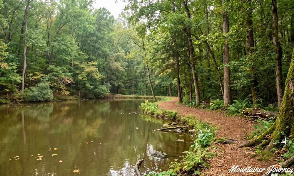
The park has maps at selected kiosks, restrooms and several water-fountain locations. Those facilities make it easier to manage a first hike, but carry drinking water rather than depending on a fountain being available at the exact point it is needed.
Practical tip: Photograph the trail map and note your parking-lot number before leaving the trailhead; Enterprise South has enough junctions to confuse a first-time visitor.
Mountain Views and Family Adventures
5. Little Cedar Mountain Main Loop
Best for: Nickajack Lake views and a moderate half-day outing
Official route: Little Cedar Mountain Main Loop
Distance: 3 miles; an additional 1-mile Pond Trail connects both sides of the loop.
Estimated time: 1.5–2.5 hours
Difficulty: Moderate
Trail type: Loop
Nearest base: Nickajack Lake
Parking: Official Little Cedar Mountain trailhead near Nickajack Dam
Fee or reservation: Free; no reservation
Dogs: Allowed on leash
Official source: Outdoor Chattanooga — Little Cedar Mountain
According to Outdoor Chattanooga, TVA maintains four miles of trails on Little Cedar Mountain. The three-mile main loop follows the lakeshore and reaches overlooks of Nickajack Lake and the surrounding mountains.
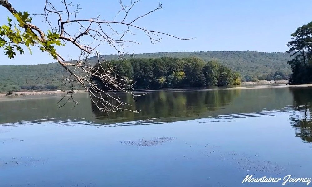
The mountain rises only about 250 feet above the lake, but the surface is not the same as a city greenway. Limestone, rocks and gradual climbs give the loop a moderate feel. The one-mile Pond Trail can be used as a connector when the group wants to alter the route.
Wildlife can be part of the appeal: deer and turkey are common in the area, while osprey and bald eagles may be seen near the lake. Give animals room and keep dogs controlled rather than approaching for photographs.
Practical tip: Leaf-off months can open wider lake views, while fall adds color; in either season, allow time for uneven ground rather than judging the hike only by its three-mile distance.
6. Sunset Rock from Cravens House
Best for: The classic Lookout Mountain view
Official route: Cravens House to Sunset Rock through the Lookout Mountain trail system
Distance: About 2 miles round trip; route choices can change the total
Estimated time: 1.5–2.5 hours
Difficulty: Moderate
Trail type: Out and back
Nearest base: Lookout Mountain
Parking: Cravens House parking area is the better starting point; parking at Sunset Rock is extremely limited.
Fee or reservation: Free for this trail route; Point Park admission is separate.
Dogs: Allowed on leash
Official source: National Park Service — Chickamauga & Chattanooga National Military Park: Lookout Mountain
Sunset Rock is the most recognizable short mountain-view hike near Chattanooga. Starting at Cravens House adds a wooded, rocky walk and avoids depending on the tiny parking area beside the overlook.
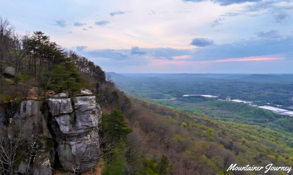
The National Park Service describes more than 30 miles of trails across Lookout Mountain and identifies Sunset Rock as a popular hiking, climbing and sunset destination. From the rock, the view opens across the valley toward the historic Wauhatchie area.
This is not a casual paved overlook. Rocks can be slippery, route junctions deserve attention and the exposed edge requires close supervision of children and dogs. NPS guidance warns that there is very little parking at Sunset Rock and that visitors must not park in the road or neighboring yards.
Practical tip: Park at Cravens House, download the official Lookout Mountain trail map and leave enough daylight for the return instead of trying to secure a space beside Sunset Rock.
7. Rainbow Lake Loop
Best for: A family adventure with a dam, creek and suspension bridge
Official route: Rainbow Lake Loop
Distance: 2.3 miles
Estimated time: 1.5–2.5 hours
Difficulty: Moderate
Trail type: Loop
Nearest base: Signal Mountain
Parking: Rainbow Lake trailhead on Ohio Avenue
Fee or reservation: Free; no reservation
Dogs: Allowed on leash
Official source: Outdoor Chattanooga — Rainbow Lake
Outdoor Chattanooga describes a 2.3-mile loop that combines an old springhouse, the dam, Middle Creek, and a roughly 100-foot suspension bridge that forms part of the Cumberland Trail.
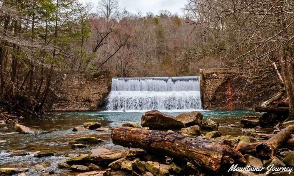
The complete 2.3-mile loop is rocky and more challenging than the number suggests. This makes it a good adventure for families with school-age children who are comfortable on uneven ground, but not a dependable stroller route or an automatic choice for very young walkers.
Visitors who do not want the full loop can descend toward the dam and return by the same route. That flexibility is useful when weather, energy or trail conditions make the longer rocky circuit less appealing.
Practical tip: Decide at the first major junction whether the group wants the full rocky loop or the shorter dam-focused outing; do not wait until everyone is tired to shorten the plan.
Waterfall and Gorge Hikes
8. Signal Point to Edwards Point
Best for: Rugged Tennessee River Gorge views
Official route: Signal Point to Edwards Point on the Cumberland Trail
Distance: About 5.6 miles round trip; the full Signal Point–Suck Creek Road section is 8.4 miles one way.
Estimated time: 3.5–5 hours to Edwards Point and back
Difficulty: Strenuous
Trail type: Out and back to Edwards Point
Nearest base: Signal Mountain
Parking: Paved Signal Point parking area
Fee or reservation: Free; no day-hiking reservation
Dogs: Keep dogs leashed and confirm current rules across the connected land-management areas.
Official source: Cumberland Trail Conservancy — Signal and Edwards Points
Signal Point to Edwards Point is a serious hike rather than a longer version of a scenic overlook visit. The route descends into Middle Creek Gorge, passes the Julia Falls overlook, crosses suspension bridges and climbs through rough terrain toward Edwards Point.
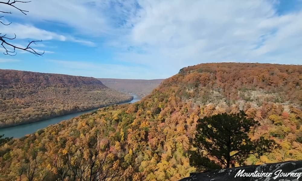
The Cumberland Trail Conservancy places Edwards Point about 2.8 miles from Signal Point, producing a roughly 5.6-mile return hike. The complete official section continues much farther to Suck Creek Road and measures 8.4 miles one way, so hikers must not confuse the two distances when planning transport or daylight.
The Cumberland Trail Conservancy warns of steep bluffs, rough rocky terrain and slick sections. Middle Creek water must be treated before drinking, and the route can feel substantially harder when wet. This is better suited to hikers already comfortable with sustained climbs and route-finding on rock.
Practical tip: Download the official map and make Edwards Point your fixed turnaround unless a separate vehicle and a point-to-point plan are already in place.
9. Ritchie Hollow Trail
Best for: A waterfall and sustained climb
Official route: Ritchie Hollow Trail
Distance: 5.4 miles round trip
Estimated time: 3–4 hours
Difficulty: Moderately strenuous
Trail type: Out and back
Nearest base: Tennessee River Gorge
Parking: Gravel lot opposite Pot Point Cabin at 17805 River Canyon Road
Fee or reservation: Free; no reservation
Dogs: Allowed on leash
Official sources: Outdoor Chattanooga — Ritchie Hollow Trail and Tennessee Division of Forestry — Prentice Cooper State Forest
Ritchie Hollow is better treated as a sustained mountain climb than a quick waterfall walk. The 2.7-mile ascent gains more than 1,200 feet as it rises from the Tennessee River through mature hardwood forest toward the Cumberland Trail.
One of the main highlights is 30-foot Blowing Wind Falls. Water flow is generally stronger following wet weather, but rain can also make roots, rock and steeper parts of the trail slippery. The route passes remnants connected to the area’s moonshine history as it climbs.
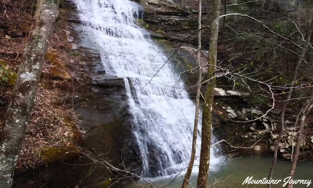
This hike suits visitors comfortable with continuous elevation gain and a five-mile outing. Families mainly seeking a relaxed waterfall stop may find Foster Falls or the easier route at Lula Lake more manageable. Because Ritchie Hollow enters Prentice Cooper State Forest, managed hunting periods can close the area to ordinary visitors on selected dates.
Practical tip: Check both the weather and the official Prentice Cooper closure information before driving to the Pot Point trailhead.
10. North Chickamauga Creek Gorge
Best for: A short creek loop with the option to continue into rugged backcountry
Official route: Hogskin Upper and Lower Loop, with an optional extension on the North Chickamauga Creek section
Distance: 1.4-mile loop; the full Montlake Road–Barker Camp Road section is 8.3 miles one way.
Estimated time: 45–90 minutes for the loop; 5–8 hours for the full section
Difficulty: Moderate on the loop; strenuous on the full section
Trail type: Loop or point-to-point
Nearest base: Mowbray Mountain
Parking: Montlake Road trailhead; the lot closes at 7 p.m.
Fee or reservation: Free for ordinary-day hiking; verify current WMA requirements.
Dogs: Check current Cumberland Trail, natural-area, and WMA rules before bringing a dog.
Official source: Cumberland Trail Conservancy — North Chickamauga Creek
North Chickamauga Creek offers two very different outings from the same general trail system. The Hogskin Upper and Lower trails form a 1.4-mile loop near the Montlake Road trailhead, following the creek before climbing to reconnect on the escarpment.
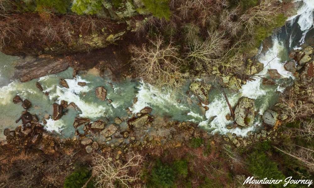
Continuing beyond the loop changes the character of the hike. The full 8.3-mile point-to-point section includes mining remains, steep ascents, ladders, rugged descents and creek fords. High water and rain make crossings and rock surfaces more hazardous, while some turns are easy to miss.
The long route requires transport planning because it finishes at Barker Camp Road. The Cumberland Trail Conservancy advises visitors not to block the Barker Camp gate and notes reports of vehicle break-ins there. At Montlake Road, day hikers need to be back before the parking area closes.
Practical tip: First-time visitors should complete the 1.4-mile loop before deciding to explore farther; attempt the full section only with an offline map, enough daylight and arranged transport.
11. Lula Lake Core Preserve
Best for: A planned waterfall day with controlled access
Official route: Lula Lake Out and Back
Distance: 4.2 miles round trip
Estimated time: 2–3 hours
Difficulty: Easy by the preserve’s route rating; the distance and return climb may feel moderate to some visitors
Trail type: Out and back
Nearest base: Lookout Mountain, Georgia
Parking: One reservation provides one regular vehicle space
Fee or reservation: Reservation required; currently $16 per vehicle reservation
Dogs: Allowed on leash; dogs may not swim
Official source: Lula Lake Land Trust — Visit the Core Preserve
Lula Lake is not a place to visit spontaneously. According to Lula Lake Land Trust, the Core Preserve is generally open to the public on the first and last weekends of each month through scheduled Open Gate Days. Reservations are required, and the current $16 conservation-use fee applies to one vehicle space.
The preserve’s easiest suggested route is a 4.2-mile out-and-back with roughly 350 feet of elevation change. It follows the gravel road to Lula Lake and Lula Falls. Visitors looking for a longer outing can consider other preserve routes but should not assume that a waterfall photograph represents a short roadside stop.
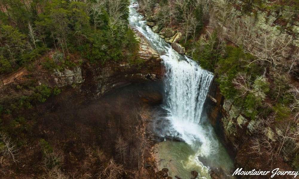
Swimming is not allowed, and visitors must return to the parking area by the preserve’s closing time. Entry cutoffs and reserved arrival windows are enforced, so the booking confirmation should take priority over information copied to third-party listings.
Because Lula Lake is across the state line, it also fits naturally into a larger itinerary built around the best hikes in Georgia or other North Georgia trails.
Practical tip: Reservations are released in advance and popular dates can fill; book first, then plan the rest of the day around the confirmed arrival window.
Challenging and Full-Day Hiking
12. Foster Falls and the Fiery Gizzard Trail
Best for: A short waterfall visit or a serious full-day hike
Official route: Foster Falls access route or the full Fiery Gizzard Trail
Distance: Short waterfall route; 12 miles point to point for the full Fiery Gizzard Trail
Estimated time: 1–2 hours around Foster Falls; 7–10 hours for the full trail
Difficulty: Moderate for the falls area; strenuous for the full trail
Trail type: Out and back or point to point
Nearest base: Tracy City and Fiery Gizzard State Park
Parking: Fiery Gizzard South trailhead at Foster Falls
Fee or reservation: Day hiking is free; camping requires a reservation
Dogs: Allowed on leash
Official sources: Outdoor Chattanooga — Foster Falls and Friends of the Parks — Fiery Gizzard Trail
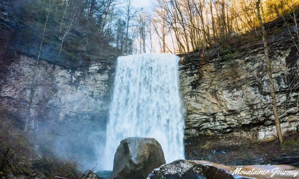
Foster Falls lets visitors choose between a focused waterfall outing and one of the region’s more demanding trail days. The upper approach is easy, but reaching the lower view requires a short, steep descent and a suspension-bridge crossing. The 60-foot waterfall and surrounding cliff line also make this a major climbing area.
The full Fiery Gizzard is a different commitment. The 12-mile trail connects the south and north trailheads and includes steep elevation changes, long rocky sections and boulder hopping. Friends of the Parks recommends planning transport at the opposite end rather than assuming an out-and-back is practical.
Daylight is part of the difficulty. Completing the full trail in winter can be unrealistic for many hikers because the route is long and the days are short. Camping creates another option, but designated sites require reservations and should not be treated as a last-minute backup.
Practical tip: Decide before arriving whether the objective is Foster Falls or the full Fiery Gizzard; do not turn a short waterfall visit into an unplanned long-distance hike.
Best Chattanooga Trail by Visitor Type
| Visitor type | Best option | Why it fits |
| First-time visitor | Sunset Rock from Cravens House | Classic view with manageable mileage |
| Beginner on paved terrain | Tennessee Riverwalk | Flat surface and flexible turnaround |
| Beginner on a dirt trail | Poe Run Path | Officially identified as Enterprise South’s easiest trail |
| Family with young children | Greenway Farm | Easy paths with an optional harder loop |
| Family wanting more adventure | Rainbow Lake | Dam, creek and suspension bridge |
| Staying near downtown | Stringer’s Ridge | Urban trail network with a city overlook |
| Lake-view seeker | Little Cedar Mountain | Nickajack Lake and mountain scenery |
| Waterfall-focused visitor | Lula Lake or Foster Falls | Planned preserve day or more flexible access |
| Intermediate hiker seeking a climb | Ritchie Hollow | Waterfall plus sustained elevation gain |
| Experienced gorge hiker | Signal Point to Edwards Point | Rocky terrain and major river-gorge views |
| Flexible short or long route | North Chickamauga Creek | 1.4-mile loop or demanding extension |
| Full-day hiker | Fiery Gizzard Trail | Long point-to-point route with rugged terrain |
Best Time to Hike Near Chattanooga
Spring and fall are the most comfortable seasons for many hikers near Chattanooga. Spring generally offers stronger waterfall flow and wildflowers, while fall brings cooler temperatures and foliage. Summer can still work with an early start, and winter is useful for shorter leaf-off-view hikes when trails are free of ice.
Spring
- Best for: Waterfalls, wildflowers and fresh forest growth.
- Main caution: Rain can make roots, creek crossings and rock steps slippery.
- Good choices: Ritchie Hollow, Foster Falls and Lula Lake.
Summer
- Best for: Early walks and shaded woodland routes.
- Main caution: Heat and humidity can make moderate trails feel harder; shade does not remove heat risk.
- Good choices: Poe Run Path, Rainbow Lake or a short Tennessee Riverwalk segment early in the day.
Fall
- Best for: Cooler hiking weather, foliage and long-range views.
- Main caution: Popular overlooks and small parking areas can fill on clear weekends.
- Good choices: Little Cedar Mountain, Sunset Rock and Signal Point to Edwards Point.
Winter
- Best for: Leaf-off views, quieter trails and shorter outings.
- Main caution: Ice, wet rock and limited daylight can affect both footing and turnaround time.
- Good choices: Stringer’s Ridge, Little Cedar Mountain or Sunset Rock when conditions are safe.
Safety and Practical Guidance
- Open the official land-manager page on the morning of the hike and check alerts, closures, reservations and hours.
- Download an offline map before leaving home and keep a backup route plan. Our guide on how to avoid getting lost while hiking explains how to prepare offline maps, recognize wrong turns and respond if you become disoriented.
- Carry water rather than depending on a creek or park fountain. Natural water must be treated before drinking.
- Wear shoes with dependable grip. Rainbow Lake, Signal Point, Ritchie Hollow, North Chickamauga and Fiery Gizzard contain rocks, roots or steep sections.
- Stay back from bluff edges and waterfalls. Wet rock can be slick even when the surrounding trail seems dry.
- Check hunting schedules for routes crossing Prentice Cooper State Forest or wildlife-management land.
- Keep dogs leashed where permitted and verify route-specific rules. Riverwalk pet access changes between segments.
- Pack out rubbish, stay on marked trails and do not enter old mines, cross onto private land or create shortcuts.
Common Mistakes to Avoid
- Confusing a viewpoint route with the full trail section: Signal Point to Edwards Point is about 5.6 miles round trip. The complete official section to Suck Creek Road is 8.4 miles one way and needs a different transport plan.
- Choosing a trail from photographs alone: A waterfall or overlook image does not show the climb, parking limit, creek crossing or rough return route. Read the route details before selecting the hike.
- Assuming every waterfall has strong flow: Rain can improve waterfall volume, but it can also create slippery rock, mud and difficult creek crossings. More water does not automatically mean better hiking conditions.
- Arriving too late: Parking gates, preserve entry cutoffs and sunset can end a hike early. This matters at North Chickamauga, Lula Lake and every longer gorge route.
- Depending entirely on a phone signal: Save the official map before leaving town. A trail app is useful, but it should not be the only route information available.
- Treating dog rules as identical everywhere: Dog access varies by trail and land manager. Before bringing a pet, confirm the rules for the complete route and review our guide to the best hiking dogs and trail-safety tips. Keep dogs leashed wherever required.
- Trying to combine two strenuous hikes: Ritchie Hollow, Signal Point to Edwards Point and the full Fiery Gizzard each deserve their own time. Combining demanding trails can turn a well-planned day into a rushed return.
Final Verdict
For a first visit, Sunset Rock from Cravens House is the best overall introduction to hiking near Chattanooga. It provides the classic Lookout Mountain setting without requiring a full-day route.
Choose Tennessee Riverwalk for the easiest paved outing, Poe Run Path for a beginner woodland hike and Greenway Farm for the most flexible family plan. Rainbow Lake is the best family adventure when everyone can manage rocky footing.
For harder terrain, Signal Point to Edwards Point delivers the strongest gorge experience, while Ritchie Hollow combines a waterfall with a sustained climb. Lula Lake is the planned waterfall day; Foster Falls works better when a reservation is not part of the plan.
The full Fiery Gizzard Trail is the serious full-day choice. Treat it as a point-to-point hike with transport, daylight and emergency planning, not as an extension to an unplanned waterfall stop.
Planning a longer Southern Appalachian trip? Compare these routes with our guide to hiking trails around Asheville.
Frequently Asked Questions
Dog access varies by trail and land manager. Some routes allow leashed dogs, while Tennessee Riverwalk rules change between segments. Check the official page for the complete route rather than relying only on the starting trailhead.
Yes. Public visits to Lula Lake Core Preserve require a reservation for an Open Gate Day. One reservation covers one regular vehicle space, and visitors should confirm the current fee, dates and arrival cutoff before visiting.
Yes. Many Chattanooga hiking trails have no day-use fee, including Stringer’s Ridge, Enterprise South, Rainbow Lake and Little Cedar Mountain. However, some locations may require reservations, parking payments, permits or separate admission.
Use the Cravens House parking area and approach Sunset Rock through the Lookout Mountain trail system. Parking beside Sunset Rock is extremely limited, and visitors must not park in the street or neighboring residential yards.
An offline map is strongly recommended for longer or more complex routes, including Signal Point, Ritchie Hollow, North Chickamauga Creek and Fiery Gizzard. Download the official map before leaving and do not rely entirely on cellular service.
Yes. Trails crossing state forests or wildlife-management land may close or operate under additional rules during managed hunts. Check the relevant land manager’s closure calendar shortly before visiting, especially for routes near Prentice Cooper State Forest.
Official Source Directory
- Outdoor Chattanooga
- Hamilton County Parks and Recreation
- National Park Service — Chickamauga & Chattanooga National Military Park
- Cumberland Trail Conservancy
- Tennessee Division of Forestry — Prentice Cooper State Forest
- Lula Lake Land Trust
- Friends of the Parks
If you notice an outdated detail or broken source link, email mountainerjourney@gmail.com with the article URL and a reliable supporting source.

