

Last updated: October 14, 2026
Asheville’s elevation shapes everything about a visit: the weather, the views, how hard the hikes feel, even how your bread bakes. This guide answers the two questions travelers ask most, explains the Blue Ridge Mountains the city sits in, and shows what the numbers mean for your trip in practical terms.
What Is the Elevation of Asheville, North Carolina?
Asheville sits at about 2,130 feet above sea level, in the French Broad River valley of western North Carolina. That is high enough to cool the summers noticeably compared to Charlotte or Atlanta at the same latitude, but low enough that altitude sickness is not a concern. The number that matters more for visitors is how fast elevation rises around the city: trailheads 20 minutes away sit 3,000 feet higher.
Is Asheville in the Mountains?
Yes. Asheville sits in a valley where the Blue Ridge Mountains meet the Smokies, with peaks on nearly every side. Ridgelines are visible from downtown, and the Blue Ridge Parkway passes the city’s east side. It is a mountain city in the fullest sense.
Our guide to Asheville’s location has the full map picture, including how to get here.
The Blue Ridge Mountains, Explained
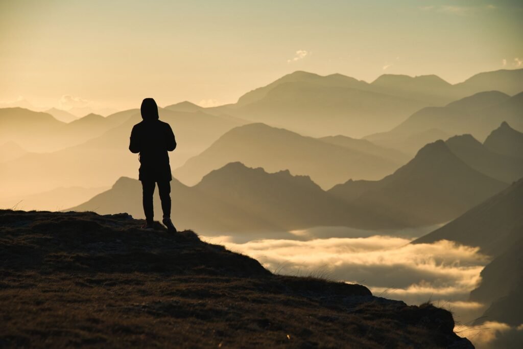
The Blue Ridge is a province of the Appalachian Mountains running from Pennsylvania to Georgia, and the North Carolina section holds its highest peaks. The “blue” in the name comes from the haze: trees release organic compounds that scatter blue light, giving distant ridges their famous layered blue look, especially in summer.
These are old mountains, worn down over hundreds of millions of years, which is why they look like rolling waves rather than jagged peaks. That age also makes them biologically rich: the Southern Appalachians hold more tree species than all of Europe, and the high-elevation spruce-fir forests near Asheville are relics of the last ice age, found nowhere else this far south.
Why Asheville Is Called the “Land of the Sky”
Asheville’s oldest nickname is the “Land of the Sky,” and it comes straight from the elevation. At 2,130 feet with peaks rising thousands of feet higher on every side, the sky dominates here in a way it does not in flat country: sunsets last longer, storms are visible coming for miles, and the layered ridges give the horizon a depth that flatlanders are not used to. Writers have been using the phrase for over a century, and it still fits. When you watch evening light move across the ridges from a Parkway overlook, you will understand exactly what they meant.
How High the Sights Around Asheville Go
Downtown is just the starting line: you can gain 4,000 feet in a 45-minute drive. Here is how elevation stacks up at the places you will actually visit, from the valley floor to the highest summit in the East:
| Place | Elevation (approx.) | What it means |
|---|---|---|
| Downtown Asheville | 2,130 ft | Pleasant summers, mild altitude |
| Biltmore Estate grounds | 2,000 ft | Valley floor, easy walking |
| Blue Ridge Parkway near Asheville | 3,000 to 5,000 ft | Noticeably cooler, frequent overlooks |
| Craggy Gardens | 5,500 ft | Spruce-fir forest, big temperature drop |
| Mount Mitchell summit | Over 6,600 ft | Highest peak east of the Mississippi |
The practical takeaway: you can gain 4,000 feet of elevation in a 45-minute drive. Pack for two climates whenever you head for the high country, even in July. Our Asheville hiking guide notes the elevation profile of the major trails.
How Elevation Affects Your Trip
Weather. Temperature drops about 3 to 5 degrees for every 1,000 feet you climb. A 75-degree afternoon downtown can mean 60 degrees and wind at Craggy Gardens. Afternoon thunderstorms build over the high peaks in summer; start high hikes early.
Hiking difficulty. The air at 5,000 feet holds noticeably less oxygen than at sea level, and most visitors feel it on climbs even without true altitude sickness. A hike rated “moderate” at these elevations can feel hard if you are coming from the coast. Give yourself an easy first day.
Sun and dehydration. UV exposure increases with elevation and the mountain air is drier than it feels. Sunscreen and extra water matter more here than the mild temperatures suggest.
Where you sleep. Lodging at higher elevation means cooler nights and better views. Cabins around Black Mountain or along the Parkway corridor run noticeably cooler than downtown hotels in summer, which is worth knowing when you are choosing where to stay.
Driving. The climbs are long but the roads are good; use lower gears on descents rather than riding your brakes. In winter, elevation is everything: rain in Asheville can be ice on the Parkway 2,000 feet up.
See how that plays out across the season in our guide to Asheville’s winter weather.
Will Asheville’s Elevation Make You Sick?
No. True altitude sickness typically starts above 8,000 feet, far higher than anything in the eastern United States. At Asheville’s 2,130 feet, and even at Mount Mitchell’s 6,600-plus, the oxygen drop is modest. What visitors actually feel is exertion: hikes feel harder than the mileage suggests, especially on the first day. Drink water, pace yourself, and you will acclimate within a day or two.
Frequently Asked Questions
What is the elevation of Asheville, North Carolina?
About 2,130 feet above sea level, in the French Broad River valley of the Blue Ridge Mountains.
Is Asheville in the mountains?
Yes. Asheville sits in a valley between the Blue Ridge and Smoky Mountains, with peaks visible from downtown and the Blue Ridge Parkway passing the city’s east side.
What is the highest point near Asheville?
Mount Mitchell, about an hour away via the Blue Ridge Parkway, at over 6,600 feet: the highest peak east of the Mississippi River.
Is Asheville colder than Charlotte because of elevation?
Yes, noticeably. Asheville runs about 5 to 10 degrees cooler than Charlotte most of the year, with a bigger gap in summer. The high country around the city runs cooler still.
Do I need to worry about altitude when hiking near Asheville?
Not about altitude sickness, which is not a factor at these elevations. But expect hikes to feel harder than their mileage suggests, especially above 4,000 feet on your first day.
Why do the Blue Ridge Mountains look blue?
Trees release natural compounds that scatter blue light, creating the blue haze on distant ridges. It is most visible in summer and is the origin of the range’s name.
Final Thoughts
Asheville’s 2,130 feet is the sweet spot: high enough for mountain weather and mountain views, low enough to skip every altitude worry. Respect the elevation gain on the way up, pack the extra layer, and let the mountains do what they do. The blue haze is waiting.
For the full trip plan, see our Asheville travel guide.


